Overview
Short summary
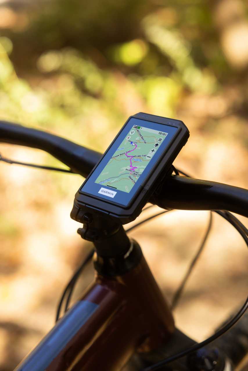
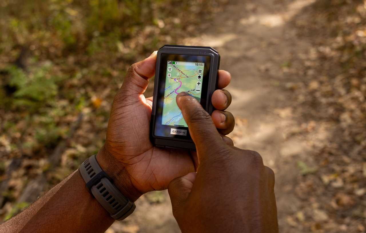
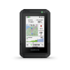
Navigation GPS for hikers, cyclists and geocaching fans. Reliable, accurate and long-lasting handheld device for every terrain.
TECHNICAL DETAILS
Registration required (cloud based)
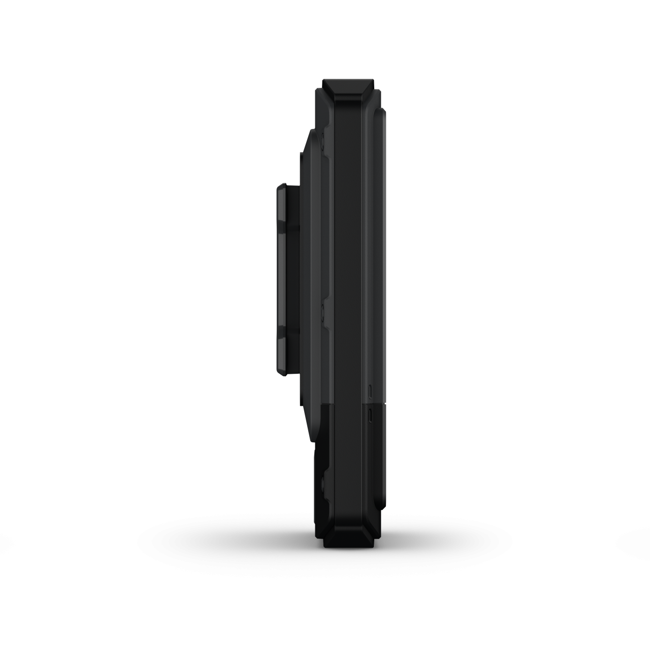
Unit dimensions, WxHxD:
66 x 105,4 x 24.6 mm
Display size:
38,8 x 64,8 mm
Display resolution
240 x 400 pixels
Display Type
3″ transflective colour TFT
Lens material
chemically strengthened glass
Battery
Rechargeable, internal lithium-ion
Operating temperature range
-20° - + 60° C
Guarantee or warranty ( for person )
2 years
Guarantee or Warranty (for company)
2 years
Training goal/ exercise motivation (Best = XXXXX)
Performance-enhancing training
●●○○○
Good feeling exercise
●●●●○
Battery Life (Accu)
Extra accurate GPS signal (All Satellite Systems and Multi-band)
130 hours
Expedition GPS activity
650 hours
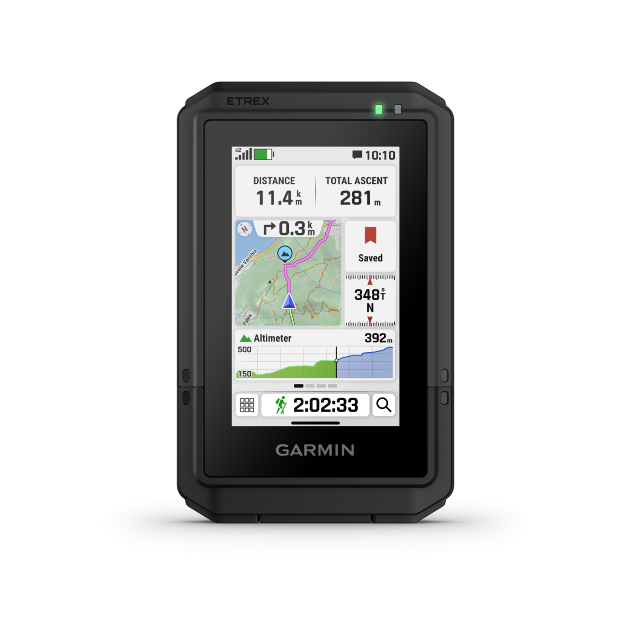
Technical specifications
Average service time (my own experience)
1-3 days
Menu languages
ENG, DAN, NED, SUOMI, FRA, DEU, ITA, NOR, POR, ESP, SWENSKA
Sound pulses leaving the zone (on / off)
Backlight: Adjustable timeout during activity & not d.a.
Backlight brightness adjustable
Font size setting
Available in 3 sizes (small, medium, large)
During use, the battery can be charged
Memory Capacity
32 GB (user space varies based on included mapping)
Factory reset
Settings > System > Reset.
CLOCK MODE
multiple time nones with ZULU/UTC
Customizing the Controls Menu
HEART RATE MEASUREMENT
Current heart rate
with heart rate sensor
Average and max. heart during exercise
with heart rate sensor
Pulse zone settings
with heart rate sensor
Calories
with heart rate sensor
HEART RATE SENSOR (external)
Package is the heart rate strap?
-
Bluetooth Smart compatible
Memory function
internal memory HRM straps supported
PRE-TRAINING FUNCTIONS
Adjustable recording rate
time based or distance based
SETTINGS DURING TRAINING
Pause training session (for red light)
SETTINGS AFTER TRAINING
Wi‑Fi® Connected Features
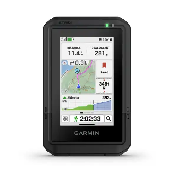
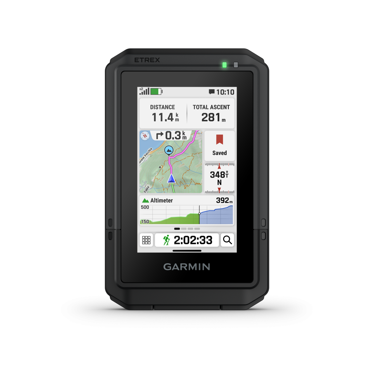
Ride summaries (speed, acceleration, decelerations, elevation, ...)
SMARTPHONE FUNCTION
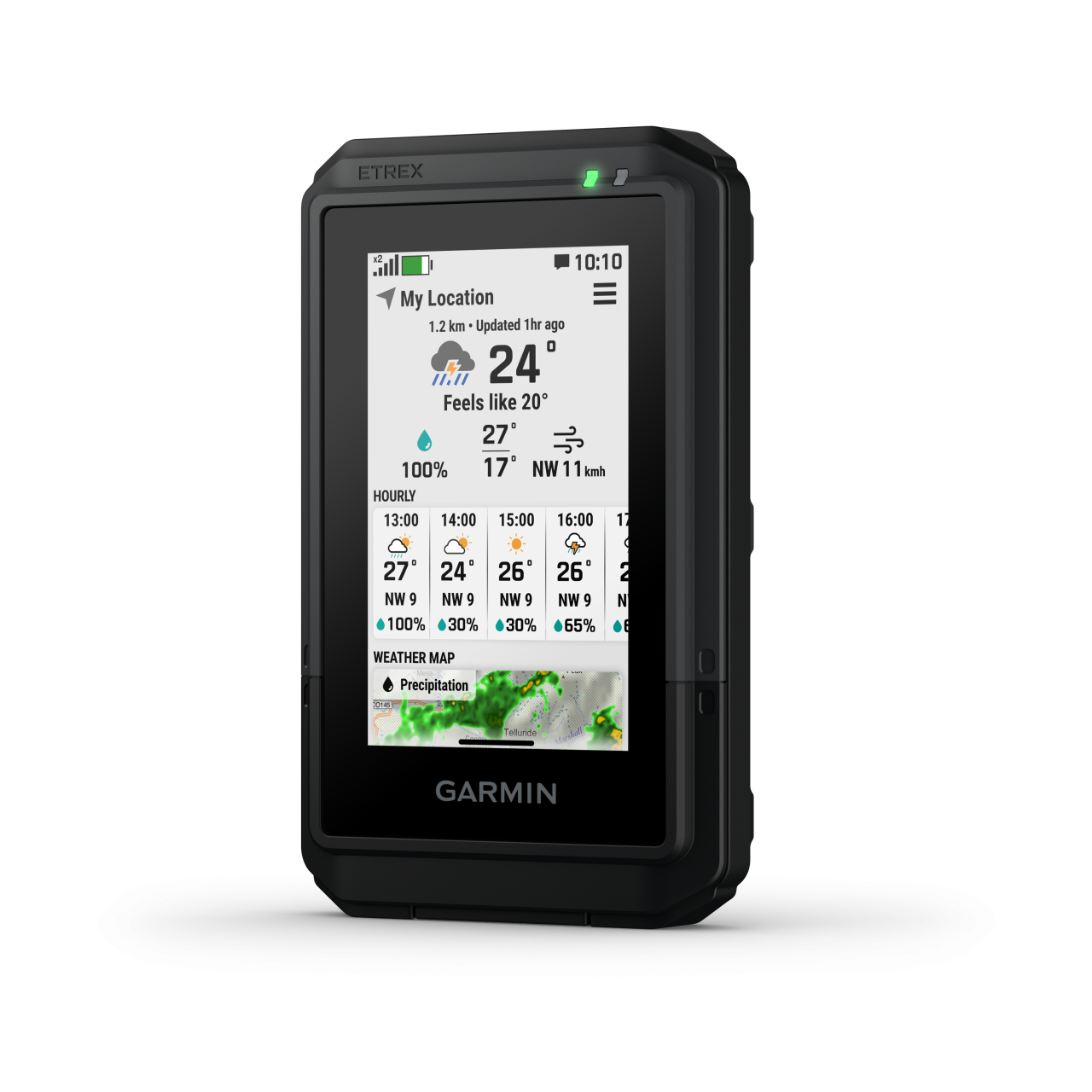
Shows shows current weather widget
APP name
Garmin Explore, Garmin Connect
Android phones
Android 9.0 or newer (BLE 4.0 or newer)
iOS system (iPhone)
iOS 16 or higher (BLE 4.0 or higher)
Notifications on the watch
Notification functions Pause
Training / tour online can be tracked from home (LiveTrack)
SAFETY FEATURES (Smartphone required)
COMPUTER CONNECTIVITY
Data transmission device in the package?
Data transfer device name
TypeC Cable
Driver Name
Garmin Express
Program name
Garmin BaseCamp, Garmin Explore (útvonalkezelés, track kezelés)
Graphical visualization exercise
Hungarian-language software
3rd PARTY APP
Data export (.gpx, .tcx, .csv)
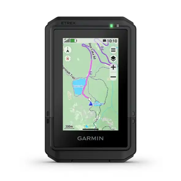
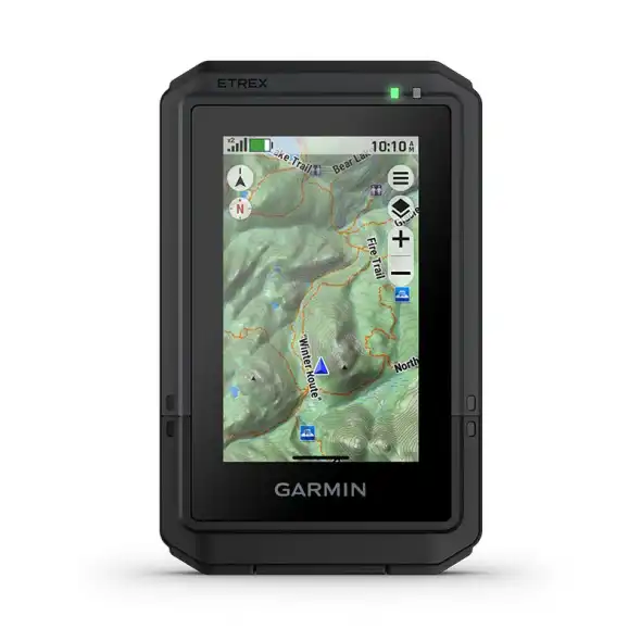
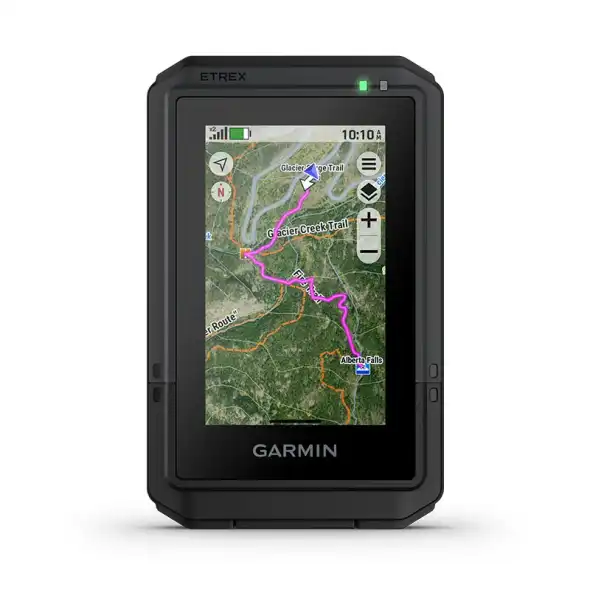
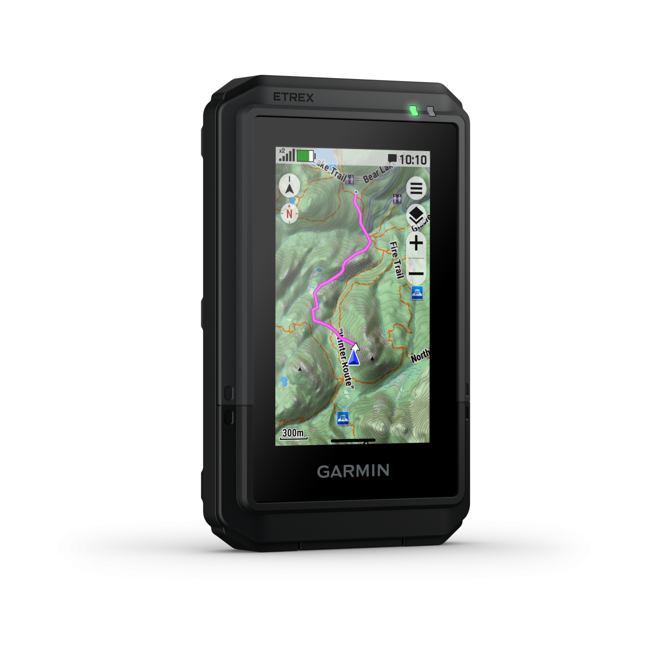
NAVIGATION FEATURES
Preloaded maps
TopoActive Europe
Can be loaded with Openmaps and / or turistautak
BirdsEye Direct Satellite Imagery
Map orientation
Heading Up or North Up option
Waypoints/favorites/locations
1000
Track and POIs on display at the same time
Can be filled from the GPS Trace
Route and elevation profiles
Downloadable cartography support
GPS FUNCTIONS
GPS (USA) satellite system compatible
GLONASS satellite system compatible (30cm Accuracy!)
Training computer displays the Route
Expandable data card
microSD support
inReach® features (requires subscription)
Send and receive text messages to SMS and email
Send and receive text messages to other inReach device
Virtual keyboard for custom messaging
Send waypoints to MapShare during trip
inReach remote compatible
Other interesting
Device Passcode Protection
CYCLING speed sensor
Package is the speed sensor?
-
Bluetooth Smart compatible
Number of cycling sensors can be taught
1
CYCLING cadence sensor
Package is the cadence?
-
Bluetooth Smart compatible
Number of hours taught-cadence
1
Boating Features
ALTIMETER FEATURES
external wireless temperature sensor (garmin tempe)
Vertical ascent in meters per hour
Altitude, ascent and descent – meters, degrees, percentage
HUNTING & FISHING
Moonrise / moonset alert (times for selected date)
AUTOMOTIVE GPS
Multi-mode (car, motorcycle, bike)
Qwerty or ABC keyboard (choose keyboard layout)
Speed limit indicator (U.S. and Europe)
only CityNavigatormaps
Tactical features
Ballistics
Applied Ballistics® (long-range shooting calculator)
Ballistics solver (unlock required)
PACKAGE CONTENTS
Charging/data cable
USB-C – USB-C

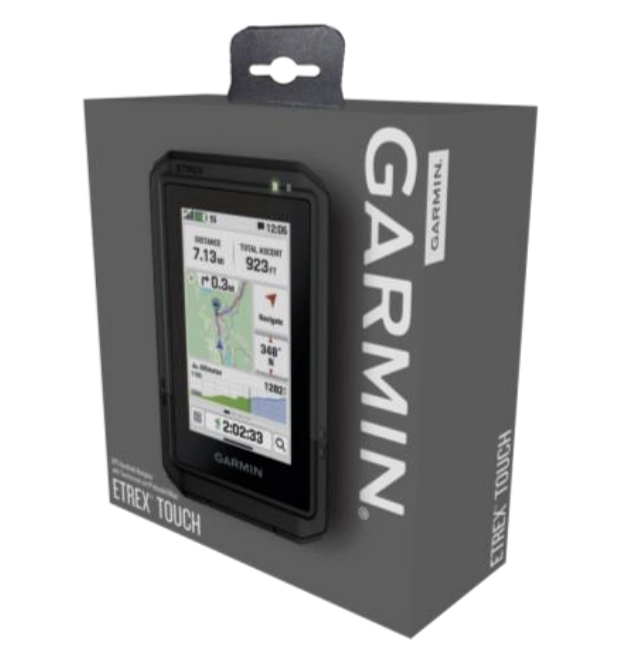 WHAT’S IN THE GARMIN ETREX TOUCH BOX?