Overview
TECHNICAL DETAILS
Training goal/ exercise motivation (Best = XXXXX)
Battery Life (Accu)
Technical specifications
SMARTPHONE FUNCTION
COMPUTER CONNECTIVITY
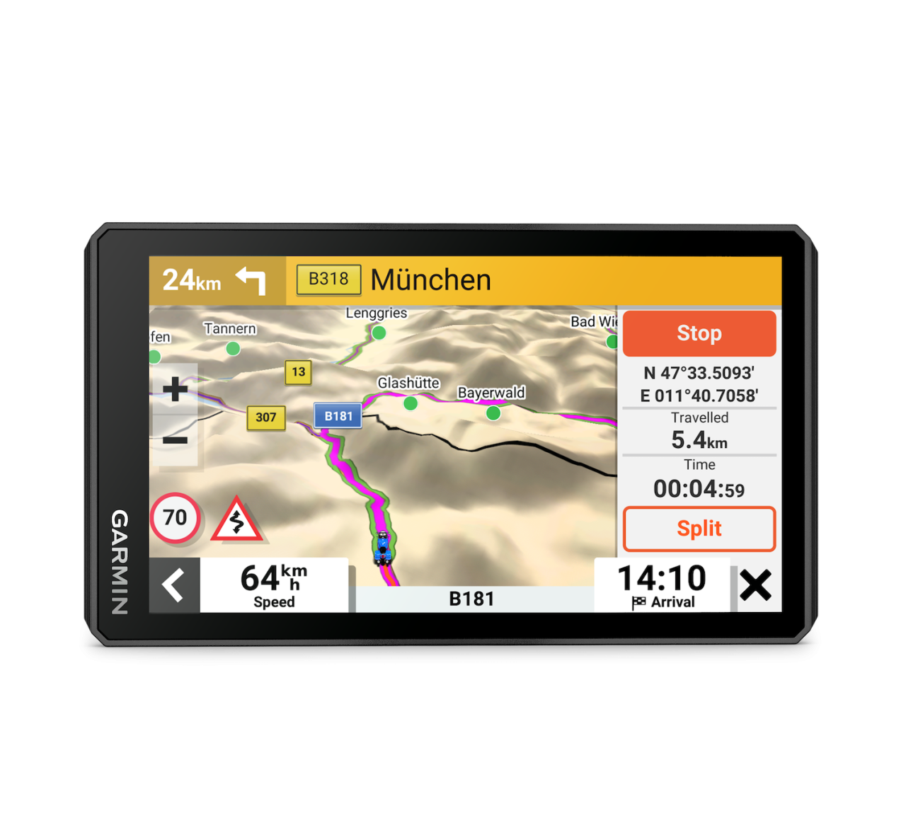
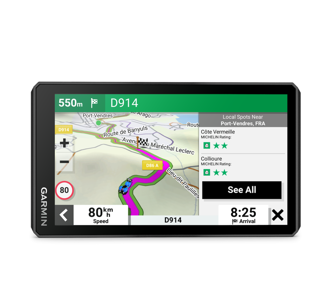
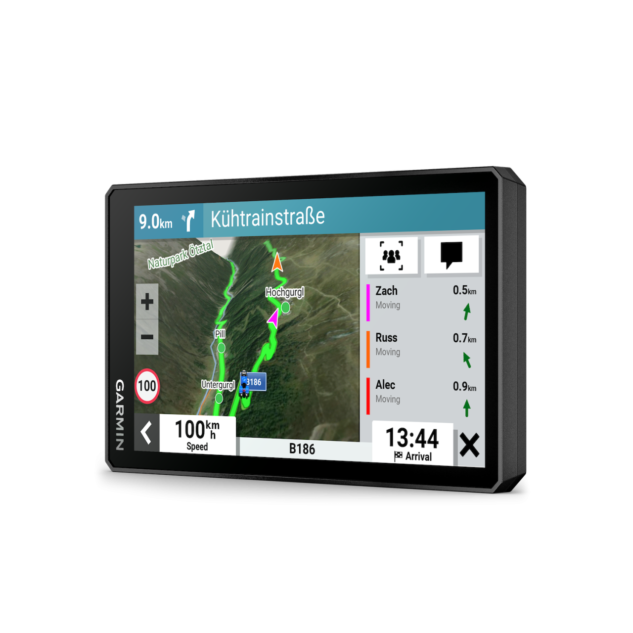
NAVIGATION FEATURES
GPS FUNCTIONS
AUTOMOTIVE GPS
PACKAGE CONTENTS
010-02781-10
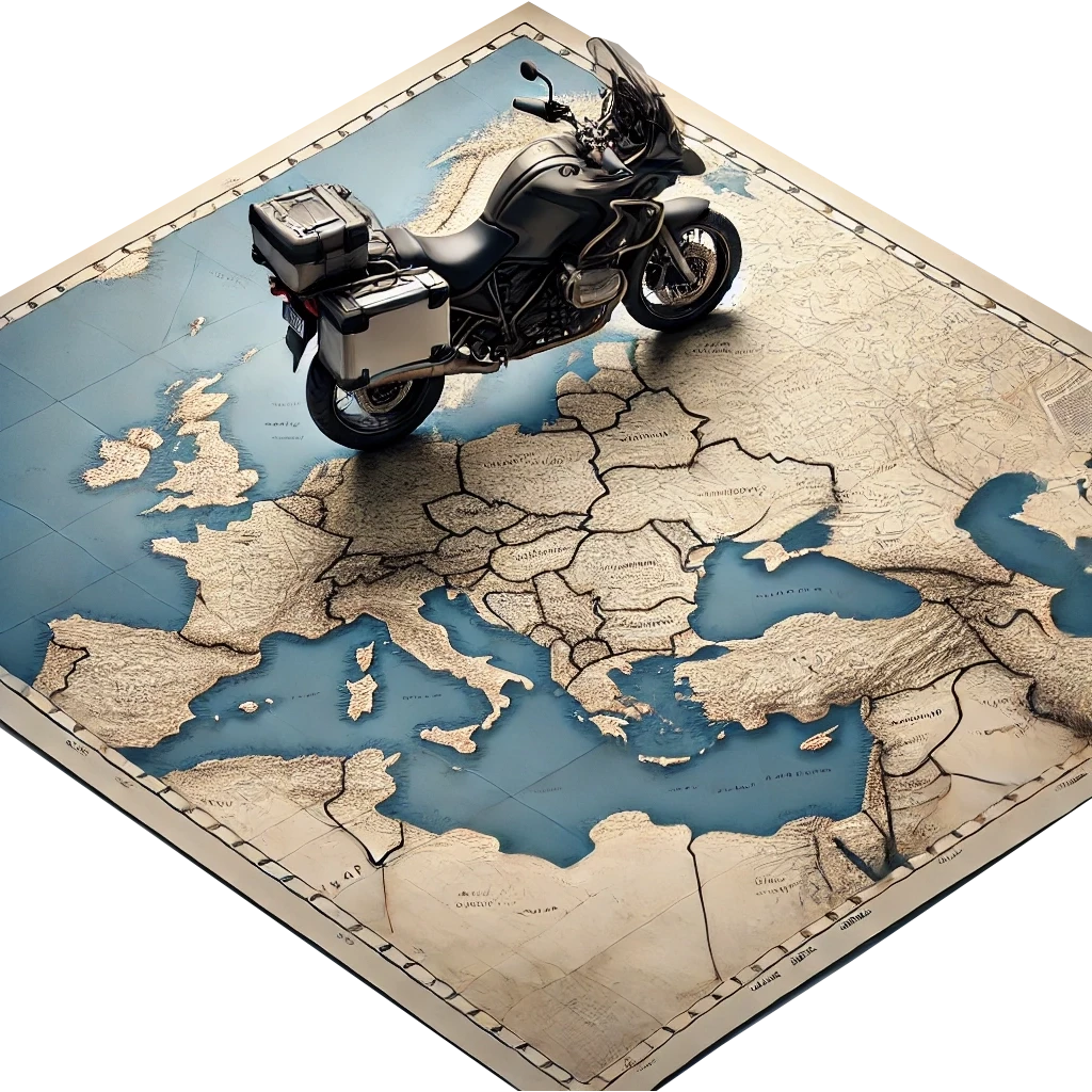
The Garmin Zumo XT2 is perfect for motorcyclists looking for reliable navigation, detailed maps, and a durable, weatherproof design for both off-road and highway adventures.
Unpack your new device with the display already perfectly protected. The price includes the protective cover/foil.

Careful implementation of the requested service can be time-consuming. Due to the service you have chosen, delivery may be one working day later than the delivery method you have selected. Thank you for your understanding.
Don't worry, just mount it on your motorcycle and use it; we'll take care of the rest.

It's important that your navigation system has the latest software and the most detailed maps. Leave that to us—we'll do it for free if you allow us to open your box.
Instalment payment
The contribution is 113 000 Ft, then pay 22 600 Ft 5 times
Instalment Summary
The Garmin Zūmo XT2 product
was successfully added to your shopping cart.


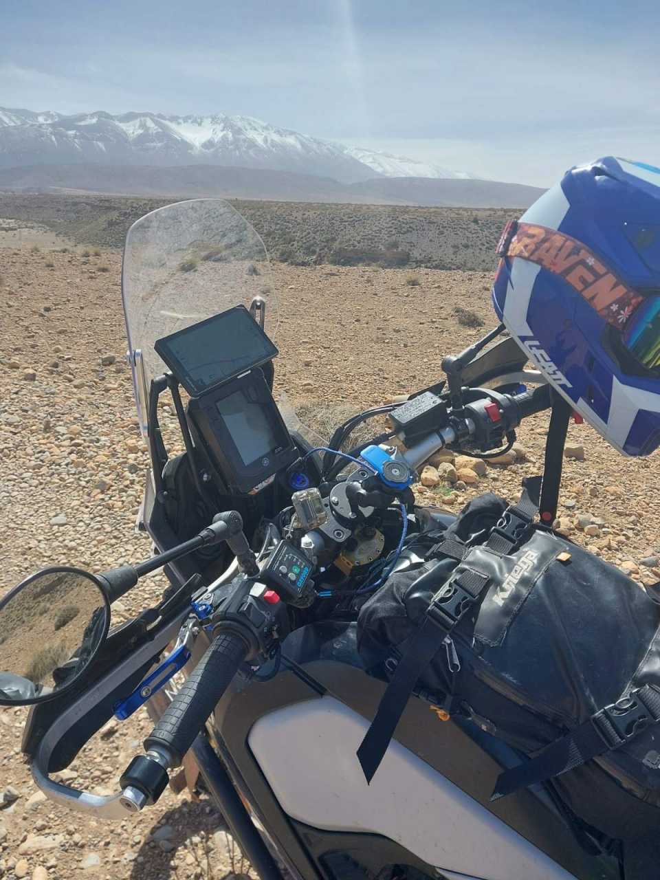
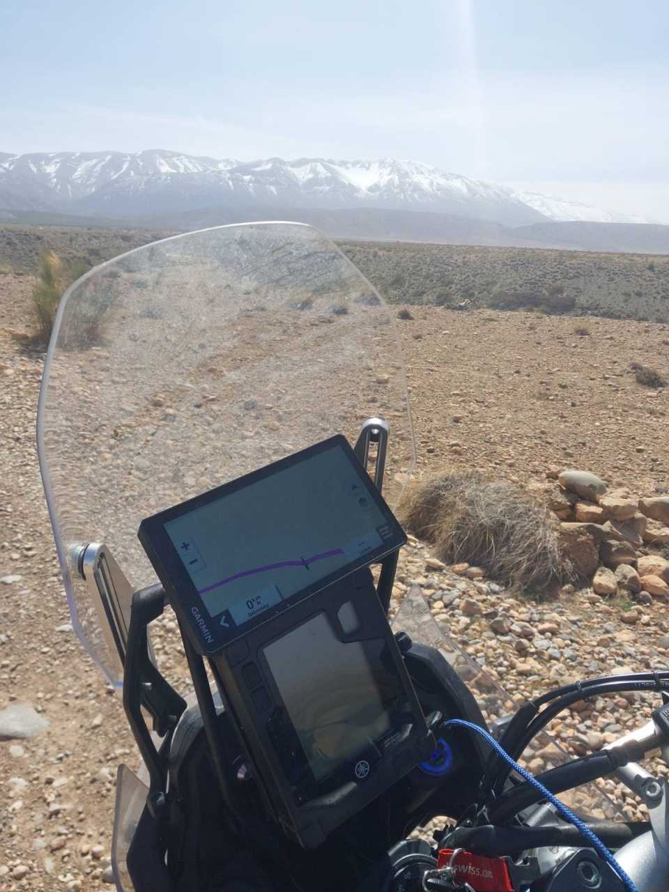
fotó: Rádi Gábor
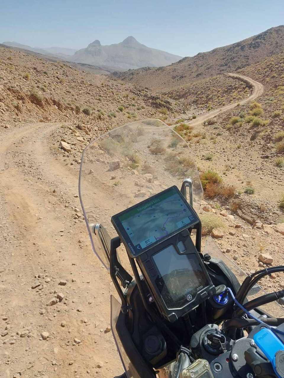
fotó: Rádi Gábor

fotó: Rádi Gábor
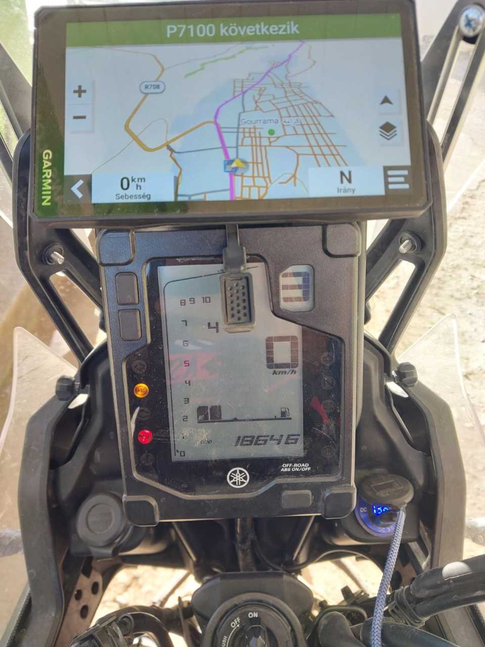
fotó: Rádi Gábor
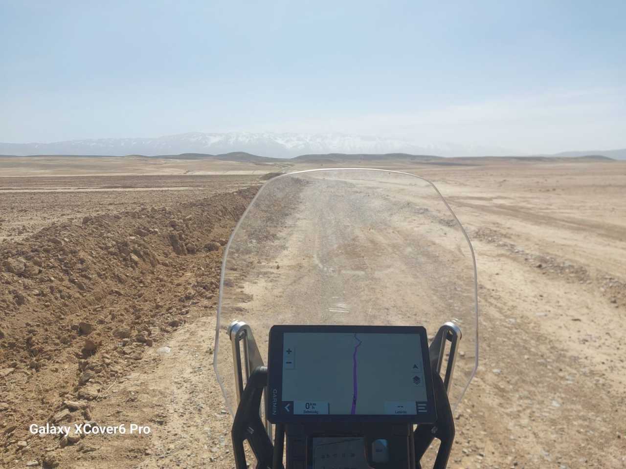
fotó: Rádi Gábor
fotó: Rádi Gábor
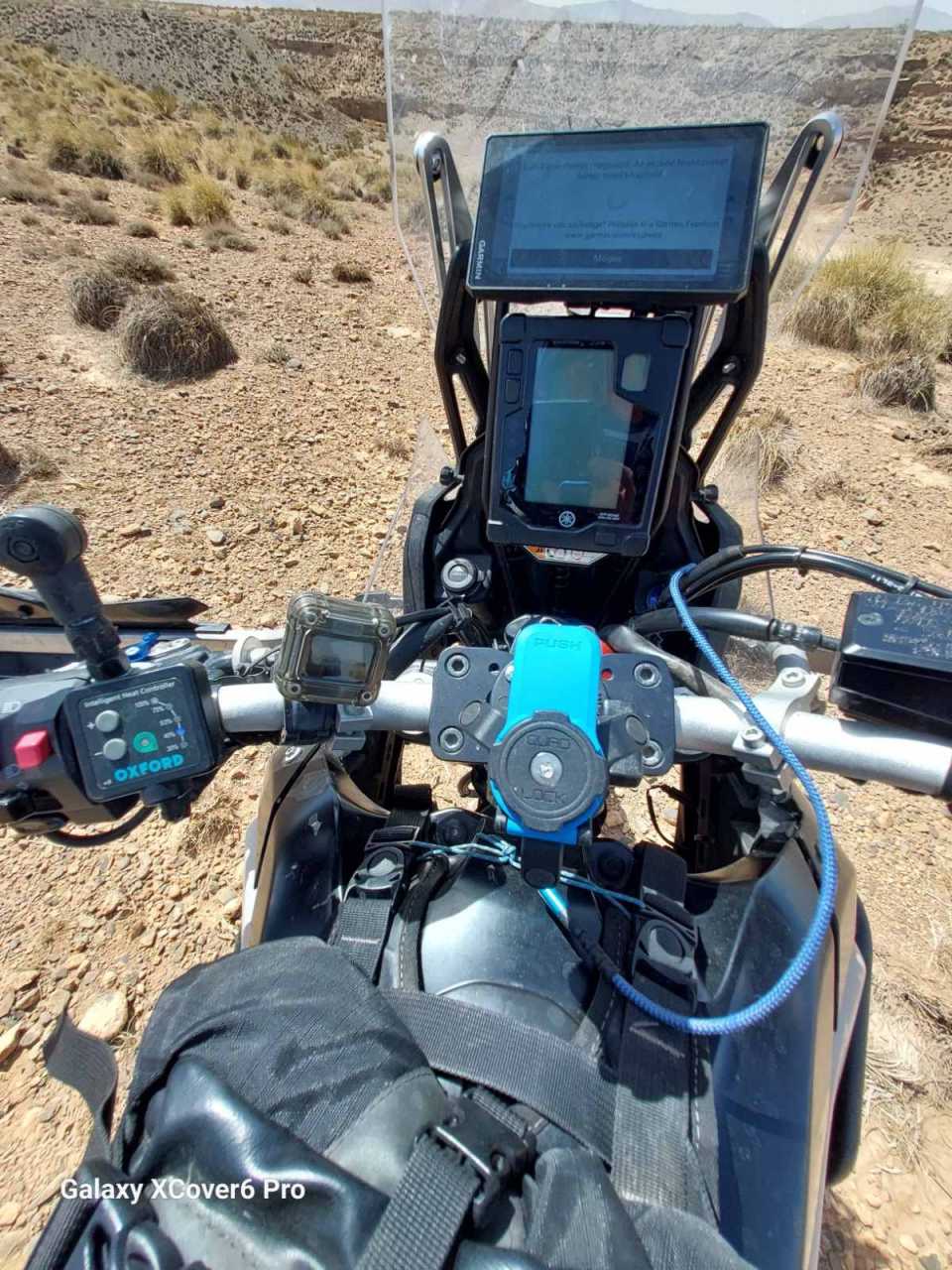
fotó: Rádi Gábor
fotó: Rádi Gábor

fotó: Rádi Gábor
Overview
TECHNICAL DETAILS
Training goal/ exercise motivation (Best = XXXXX)
Battery Life (Accu)
Technical specifications
SMARTPHONE FUNCTION
COMPUTER CONNECTIVITY
NAVIGATION FEATURES
GPS FUNCTIONS
AUTOMOTIVE GPS
PACKAGE CONTENTS
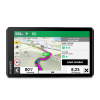
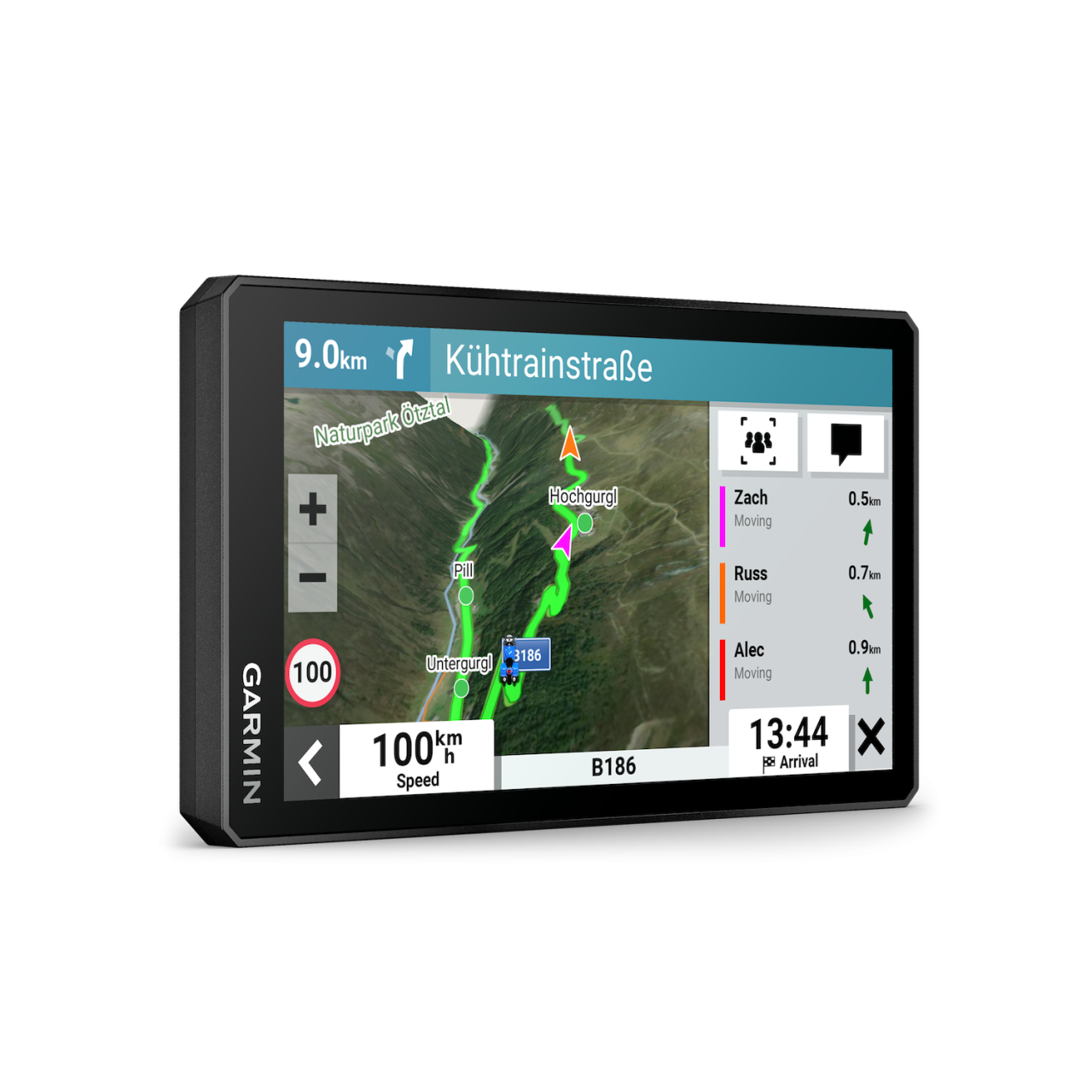
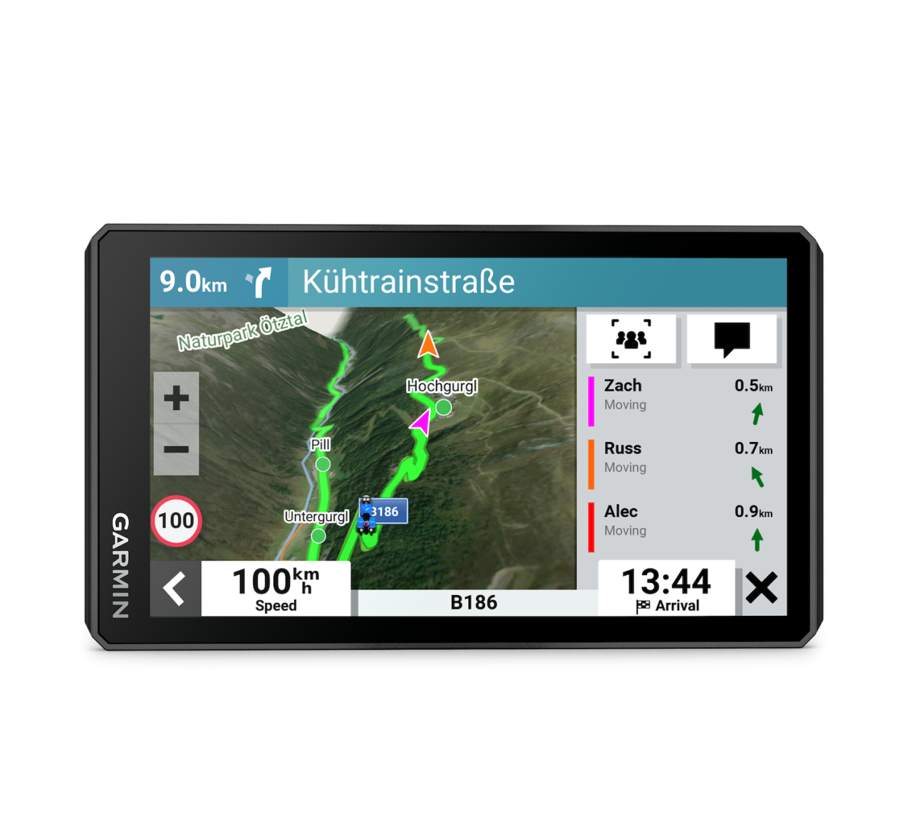
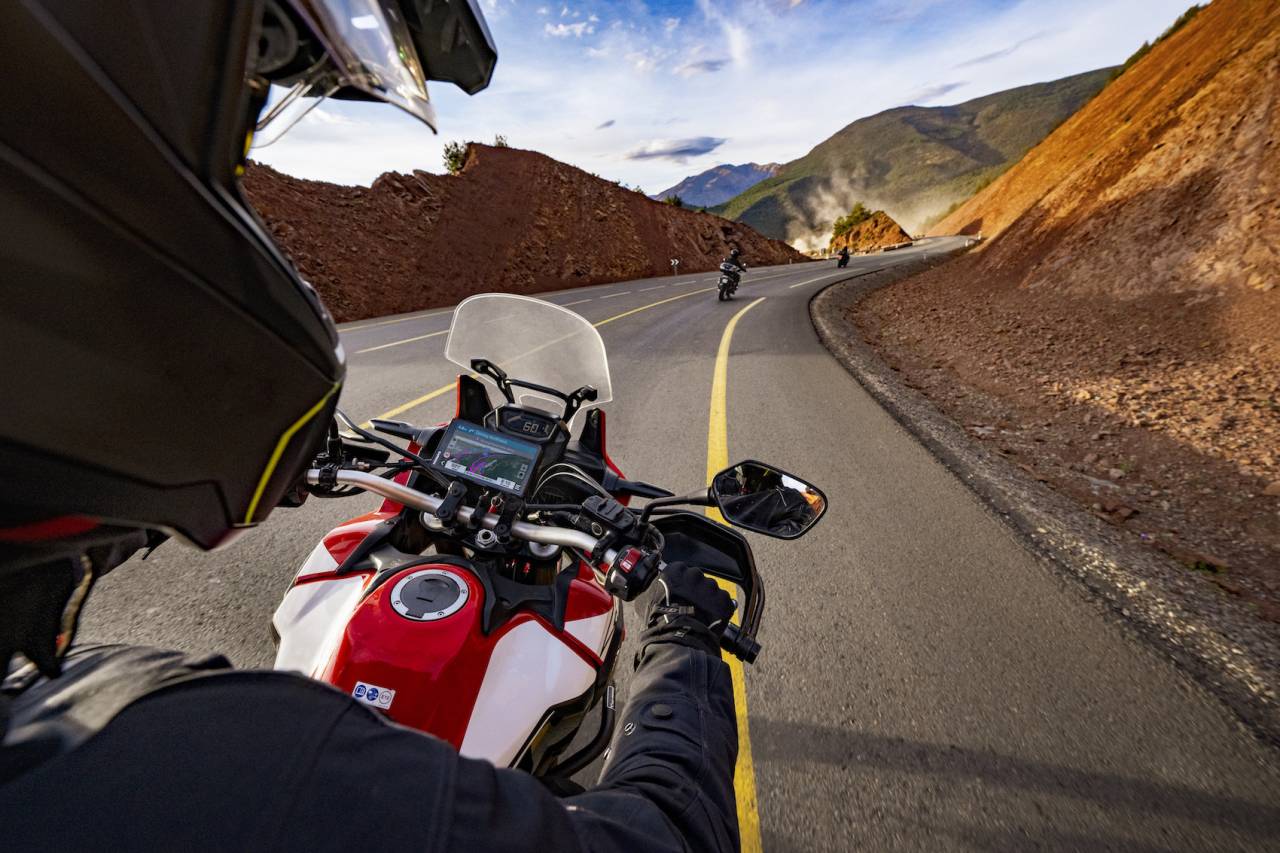
You need throttle therapy. The zūmo XT2 motorcycle navigator is your prescription to hit the road, no matter where it goes. The bright 6” display is glove-friendly and packed with features to help you find the perfect motorcycle route.

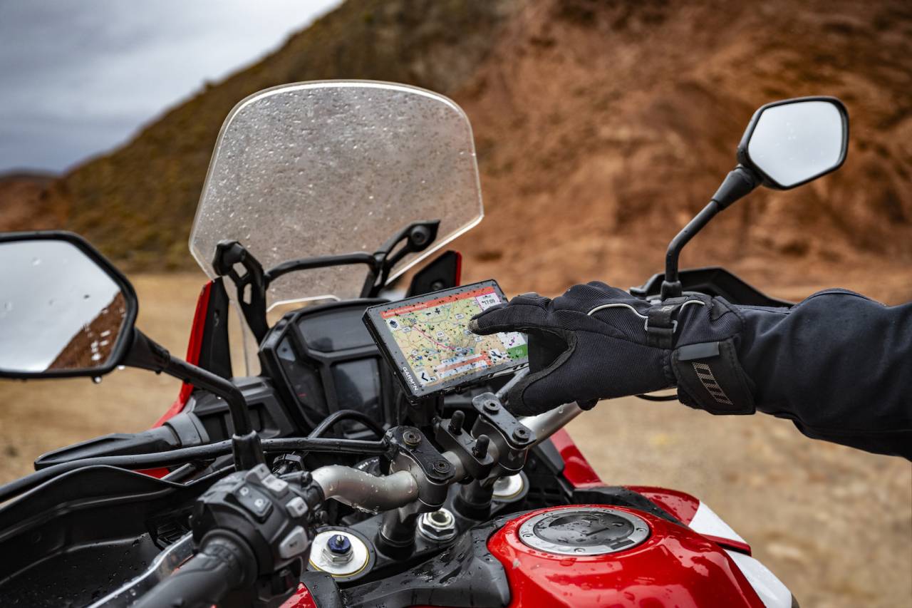
The bright 6” display is easy to read, no matter the weather or light conditions.

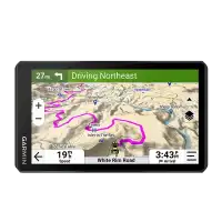
Create custom routes with the visual route planner.

Find the twists and turns with the Garmin Adventurous Routing™ setting.

See popular moto paths to discover new places to ride.

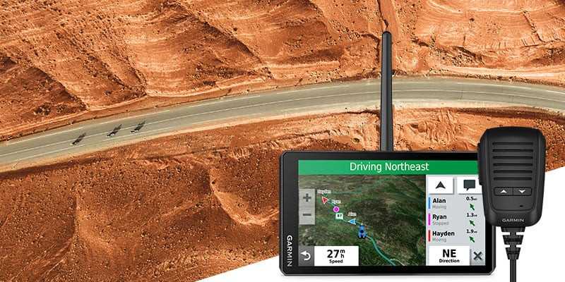
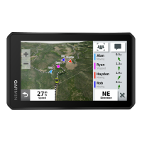
Start a group ride to see positions of other riders on the zūmo XT2 display1.

Switch from North America street maps to topographic maps to satellite imagery with just a tap.
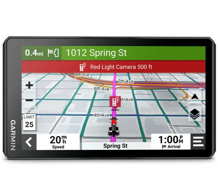
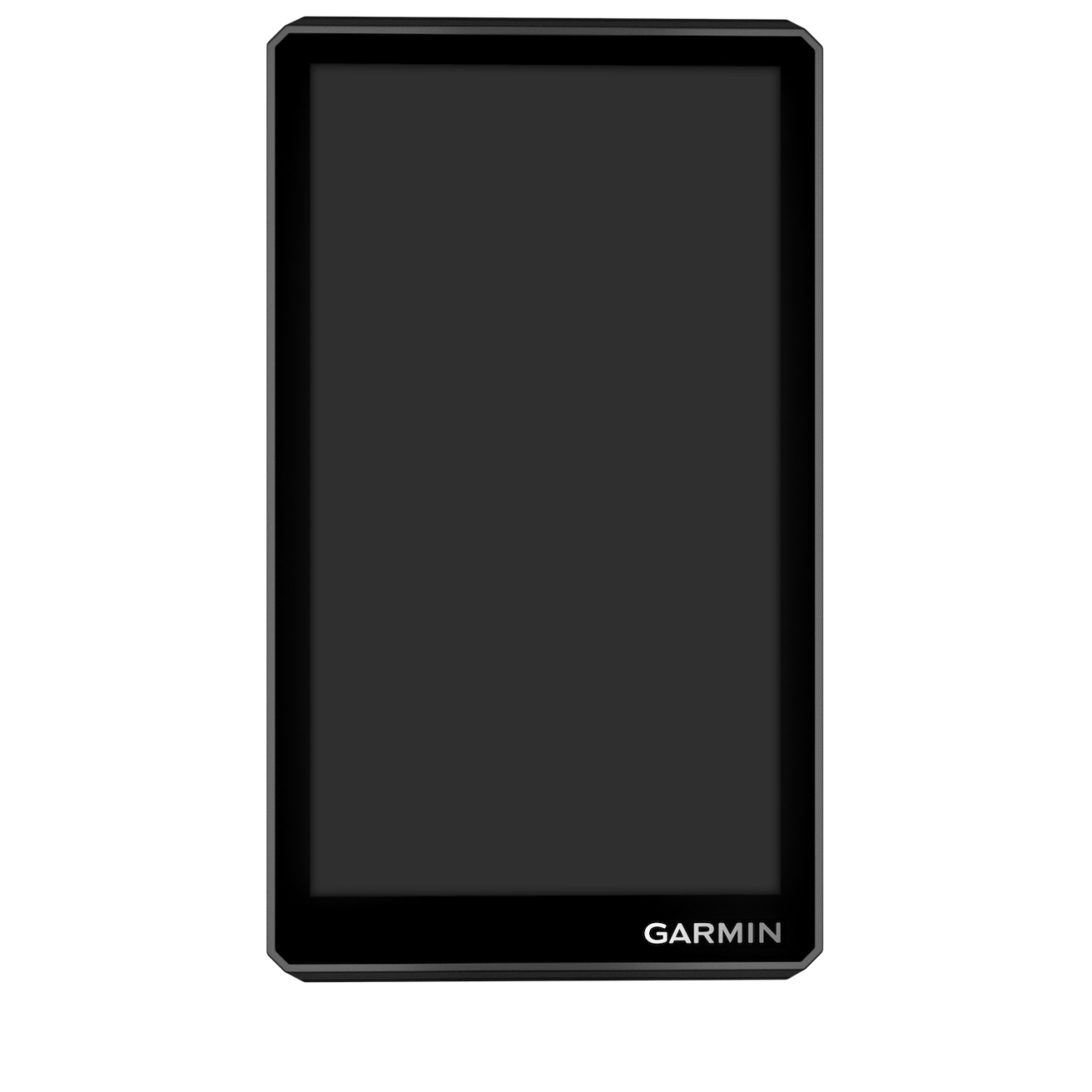
ULTRABRIGHT DISPLAY
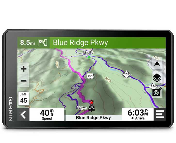
The 6” display is 15% larger than previous models and features an even brighter HD resolution in landscape or portrait mode
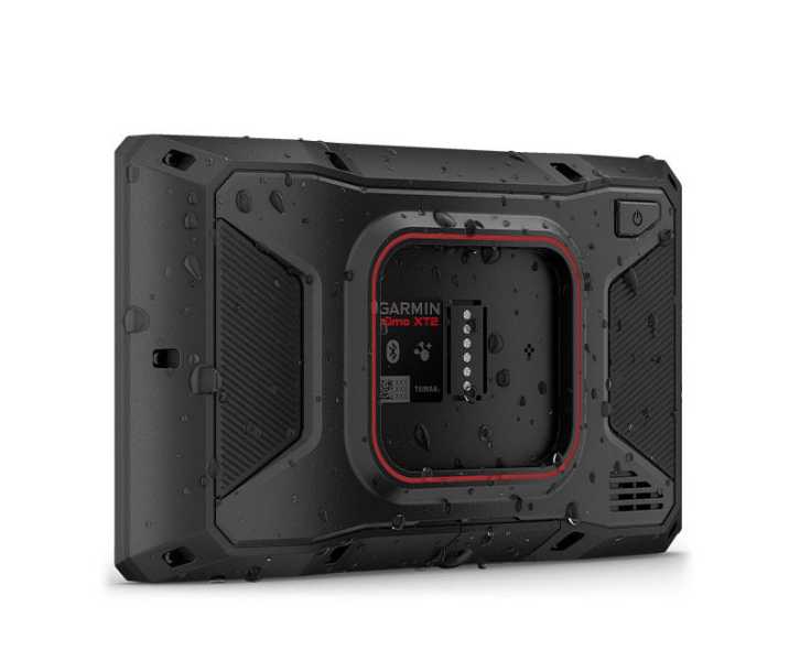
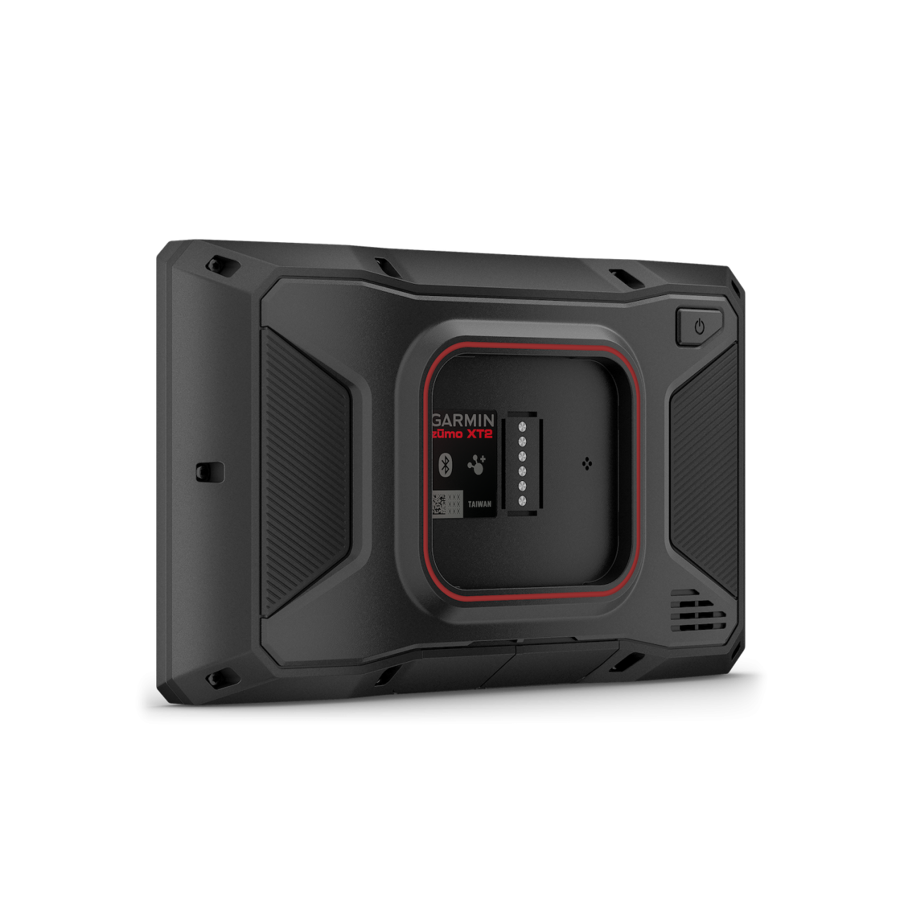
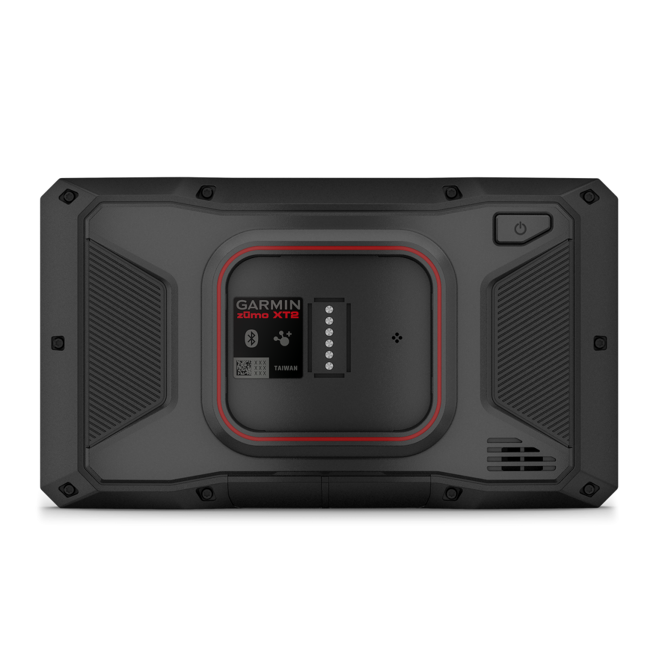
DESIGNED TO ENDURE
Rain? Vibration? Dust? Doesn’t matter. This device is built to withstand all kinds of weather (IPX7) and rough terrain.
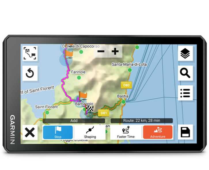
VISUAL ROUTE PLANNER
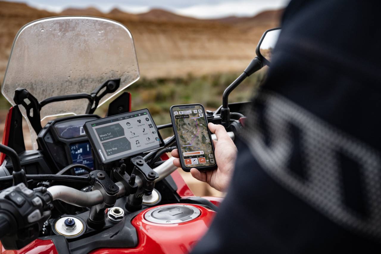
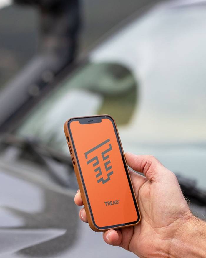
Plan a custom route on the device, or use the Tread app with a compatible smartphone.
SIMPLE MAP SWITCHING
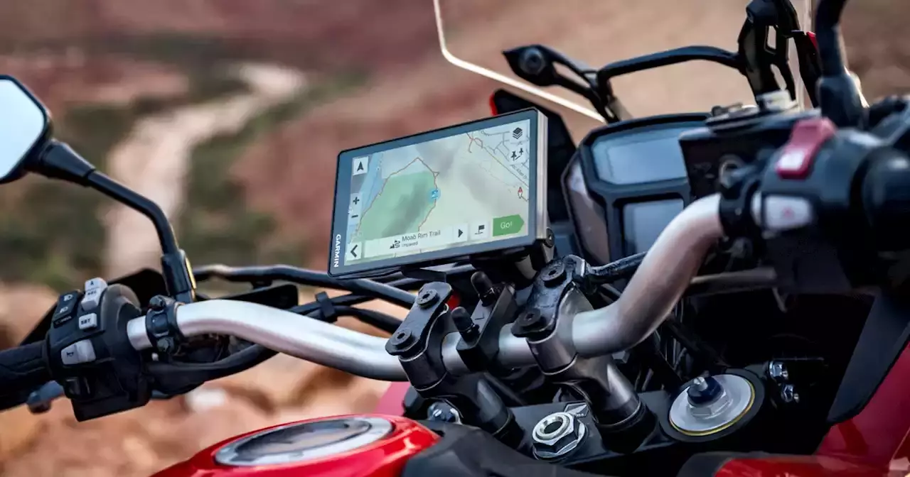
Quickly toggle between on-road maps, topographic maps and satellite imagery, so you can always have the perfect map for your ride
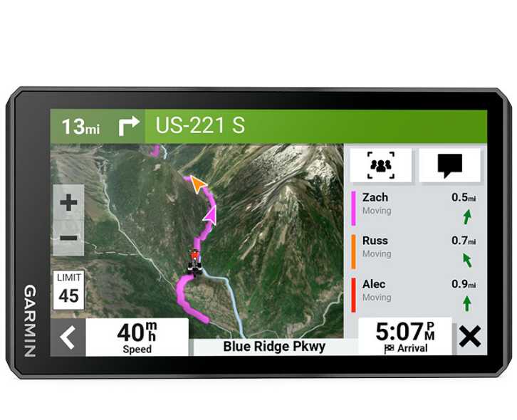
GROUP TRACKING
Use the Tread app on your smartphone and/or zūmo XT2 device to track friends with the Group Ride Mobile feature1. Or, use the Group Ride Radio accessory2 (sold separately) for tracking other zūmo XT2-equipped riders with no cellular coverage needed.
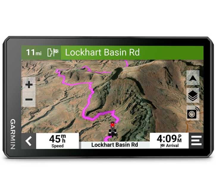
SATELLITE IMAGERY
Use satellite imagery from around the world to help you navigate. Download the maps directly to your device via Wi-Fi® technology3. No annual subscription required.

POPULAR PATHS
See popular moto paths ridden by other riders to find new and exciting routes to explore.

GARMIN ADVENTUROUS ROUTING
Straight roads are boring. Find the most thrilling routes with hills, curves and sights, and choose from 4 levels of difficulty.

RIDE SUMMARIES
Use the Tread app to review your ride details, including speed, acceleration, decelerations, elevation and more.

TRACK RECORDER
Record your ride data such speed, distance, acceleration and more and share the details with friends on Tread app.

SHARE YOUR FAVORITE ROUTES
Easily send GPX files from your phone or third-party sources to your zūmo XT2 navigator. Share GPX files with fellow riders by using the Tread app.

RIDER ALERTS
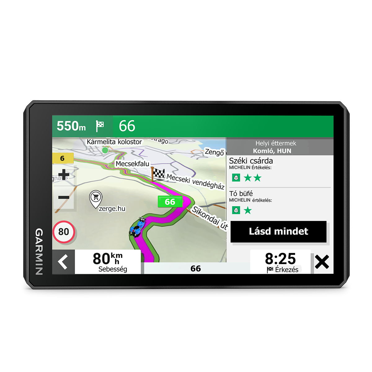
Get alerts for hazards along your route, such as upcoming sharp curves, speed changes and more. You’ll also be notified about state helmet laws and red light/speed cameras4.

MANAGE YOUR DATA
Easily manage5 tracks and routes across your navigator and compatible smartphone by using the Tread app.

MUSIC
Stream music from your smartphone through the zūmo XT2 navigator, or play MP3 files stored on the navigator — all to your connected helmet or headset.

WIRELESS UPDATES
Built-in Wi-Fi connectivity3 makes it easy to keep your maps and software up to date without using a computer. On-screen cues show when new updates are available.

LIVE TRAFFIC AND WEATHER
Access real-time traffic and weather, share routes with other riders, and get phone notifications via the Tread app5.

INREACH® COMPATIBILITY
Pair zūmo XT2 with a compatible inReach satellite communicator6 for two-way messaging, location sharing and, in case of emergencies, SOS capabilities.

BLUETOOTH® CONNECTIVITY
Hear turn-by-turn directions or stream music from your compatible smartphone through a connected helmet or headset.

INCIDENT NOTIFICATIONS
If an incident occurs, a text message with location information is automatically sent to your predetermined contact5.
CONTROL YOUR ACCESSORIES
Pair the zūmo XT2 motorcycle navigator with the compatible Garmin PowerSwitch™ digital switch box (sold separately) to enable on-screen control of your motorcycle’s 12-volt electronics.
|
1 Tracking via Group Ride Mobile requires the Tread app running on your and each friend’s compatible smartphone with BLUETOOTH® technology and an active cellular connection. © HERE. All rights reserved. Satellite Imagery © 2023 Maxar Technologies (date of satellite imagery may vary). Wi-Fi is a registered trademark of the Wi-Fi Alliance. The Bluetooth word mark and logos are registered trademarks owned by the Bluetooth SIG, Inc. and any use of such marks by Garmin is under license.
|
WHAT'S IN THE BOX?
GUARANTEE
fotó: Rádi Gábor
fotó: Rádi Gábor
fotó: Rádi Gábor
fotó: Rádi Gábor
fotó: Rádi Gábor
fotó: Rádi Gábor
fotó: Rádi Gábor
fotó: Rádi Gábor
fotó: Rádi Gábor