WHAT'S IN THE Garmin Tread 2 BOX?
- Tread 2
- Tube mount kit
- Power cable
- USB cable
- Documentation
010-02972-10
Recommended for off-road riders and adventurers: rugged, glove-friendly display, IP67 protection, fast map calculations, satellite imagery, and preloaded maps.
279 900 Ft
The amount of VAT includedThe Garmin Tread® 2 product
was successfully added to your shopping cart.
Instalment payment
The contribution is 139 950 Ft, then pay 27 990 Ft 5 times
Instalment Summary
The Garmin Tread® 2 product
was successfully added to your shopping cart.
Overview
TECHNICAL DETAILS
Training goal/ exercise motivation (Best = XXXXX)
Battery Life (Accu)
Technical specifications
SMARTPHONE FUNCTION
COMPUTER CONNECTIVITY
NAVIGATION FEATURES
GPS FUNCTIONS
AUTOMOTIVE GPS
PACKAGE CONTENTS
This rugged powersport navigator will show you the way, with navigation for all the places you love to ride.
ULTRABRIGHT GLOVE-FRIENDLY 6” DISPLAY
PRELOADED TOPOGRAPHIC MAPS WITH LANDMARKS
BUILT FOR EXTREME WEATHER
SATELLITE IMAGERY SHOWS VIVID OVERHEAD VIEWS OF YOUR ROUTE
SUPPORTS OUTDOOR MAPS+ FOR PREMIUM MAPPING (SUBSCRIPTION REQUIRED)
SNOWMOBILE TRAILS FOR THE NORTHERN U.S. AND CANADA
|
WHAT YOU'LL LOVE
|
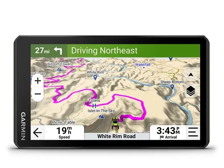
The 6” high-resolution, ultrabright and glove-friendly touchscreen navigator is purpose-built to withstand extreme temperatures and weather (IP67 dust/water rating) for rugged off-road adventures. The upgraded processor delivers faster performance, including map drawing and route calculations.
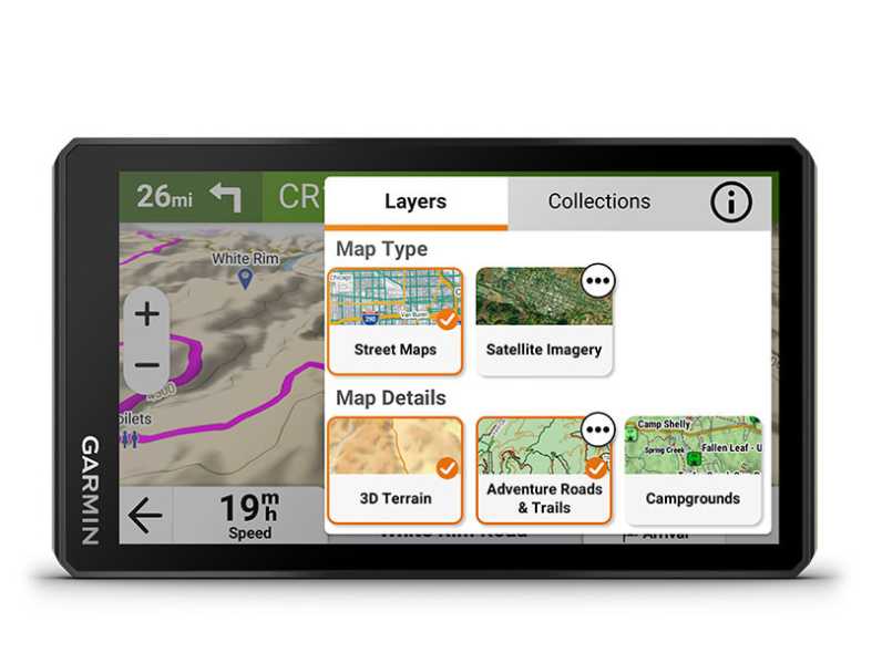
Get turn-by-turn trail navigation for unpaved roads and trails in off-road riding areas with OpenStreetMap™, U.S. Forest Service Motor Vehicle Use Maps and Adventure Roads and Trails map content1. View areas included throughout North America.
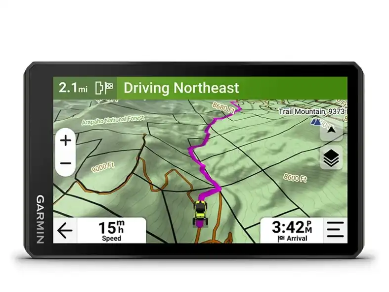
Venture off-road with high-definition digital elevation maps for dirt and snow trails, or follow City Navigator® maps for street routes1.
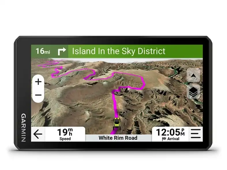
Download subscription-free satellite imagery directly to the device via Wi-Fi® technology to see high-resolution overhead views of routes and terrain.
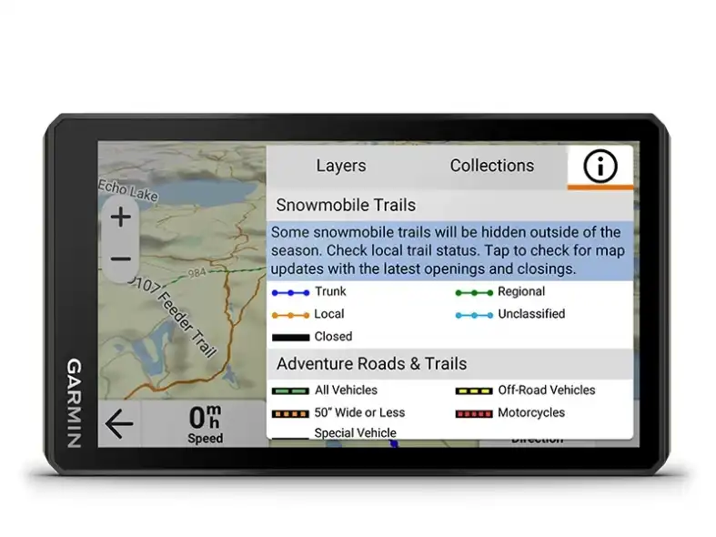
View snowmobile trail content for select areas within the U.S. and Canadian provinces; includes snowmobile-accessible locations such as fuel stops, warming shelters, restaurants and more. View coverage areas in your state or province.
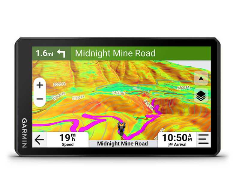
Purchase an Outdoor Maps+ subscription for ongoing access to premium map content, including slope angle, slope aspect, avalanche risk report and more. Learn more about the Outdoor Maps+ content available for Tread devices.
|
FIND NEW WAYS TO EXPLORE
|
Track friends from your compatible smartphone or Tread device when you and your friends use the Tread® app’s group ride mobile feature.
Use the Tread mobile app to easily sync waypoints, tracks, routes and collections across your mobile device and Tread 2 navigator.
For tough-terrain guidance, built-in sensors include an altimeter, barometer, compass and pitch/roll gauges.
Access public land boundaries for national forests, Bureau of Land Management, wilderness areas and more. Also, see private land boundaries and landowner information for parcels greater than 4 acres.
Easily send GPX files from your phone or third-party sources to your Tread 2 navigator. Share GPX files with fellow riders by using the Tread app on your compatible smartphone.
Get spoken turn-by-turn directions if you choose to take Tread 2 with you when you head back to civilization and want street navigation. This includes driver alerts for sharp curves, speed changes and more.
Wirelessly pair Tread 2 with your compatible Garmin GPS dog tracker to help track and retrieve your sporting dogs in the field. You’ll see markers for each dog within tracking range, overlaid right on the navigator’s map screen.
Weather ahead? Pair Tread 2 with your compatible smartphone, and download the Tread app to access live weather, storm alerts, animated radar and more.
Tread 2 comes with a preloaded directory of Ultimate Public Campgrounds to help you find more than 46,000 publicly owned camping locations across the U.S.
A built-in media player lets you easily control music loaded on your compatible smartphone on the navigator’s display — and hear your tunes through your helmet or headset enabled with BLUETOOTH® technology.
Pair your Tread 2 powersport navigator with your compatible inReach global satellite communicator2 for two-way text messaging, interactive SOS and weather.
Tread 2 includes rugged roll tube and handlebar mount options to best fit the setup of your powersport vehicle.
When you ride outside of cell coverage, pair Tread 2 with your Group Ride Radio for location sharing with your group and voice communication using the included push-to-talk fist mic. Pair Tread with your helmet or headset enabled with BLUETOOTH® technology for hands-free communication.
Get critical button control of your map, and keep your hands on the handlebars while riding, when paired with your wired handlebar controller accessory (sold separately).
Enable on-screen control for your vehicle’s 12-volt electronics — including light bars, differential locks and more — when paired with your Garmin PowerSwitch digital switch box. Not intended for controlling motors with reverse polarity.
|
1Limitations may exist in map data for some road and trail route suggestions. Always defer to all posted road signs and conditions during vehicle operation. Garmin products using OpenStreetMap data are intended to be used only as supplementary travel aids. Satellite Imagery © 2024 Maxar Technologies (date of satellite imagery may vary). OpenStreetMap is a trademark of the OpenStreetMap Foundation, and is used with their permission. This product is not endorsed by or affiliated with the OpenStreetMap Foundation. Wi-Fi is a registered trademark of the Wi-Fi Alliance. The Bluetooth word mark and logos are registered trademarks owned by Bluetooth SIG, Inc. and any use of such marks by Garmin is under license. Engineering enhancements are ongoing and may not be reflected in the pictures, videos and specifications. |
||
