 ZERGE’S OPINION IN BLACK AND WHITE ABOUT THE GARMIN GPSMAP H1.
WHO IS IT FOR AND WHAT DO I RECOMMEND IT FOR?
The GPSMAP series is recommended for those who need a reliable handheld GPS in extreme environments and under heavy use – whether it’s for hiking, mountaineering, hunting, or professional applications involving multiple people. Its rugged design, long battery life, and precise navigation ensure it performs in all conditions. And for those who also require satellite communication, messaging, and SOS functions, the GPSMAP H1i Plus is the right choice.
WHAT YOU WILL LOVE
- Touchscreen + buttons → fast and convenient, yet reliable even in storms or with gloves.
- Modern design → more compact, rugged, MIL-STD-810 tested. Practical side charging port.
- Multi-frequency GNSS → faster, more accurate positioning in tough terrain.
- TopoActive maps + satellite imagery with Outdoor Maps+ → instant, detailed navigation.
- New mounting system → works with marine, cycling, and automotive mounts.
- Built-in flashlight + siren → immediate help in darkness or emergencies.
- H1i Plus extras: camera, photo/audio messaging, two-way inReach, SOS, voice control → full safety and communication, even without a network.
WHAT I MISS
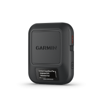
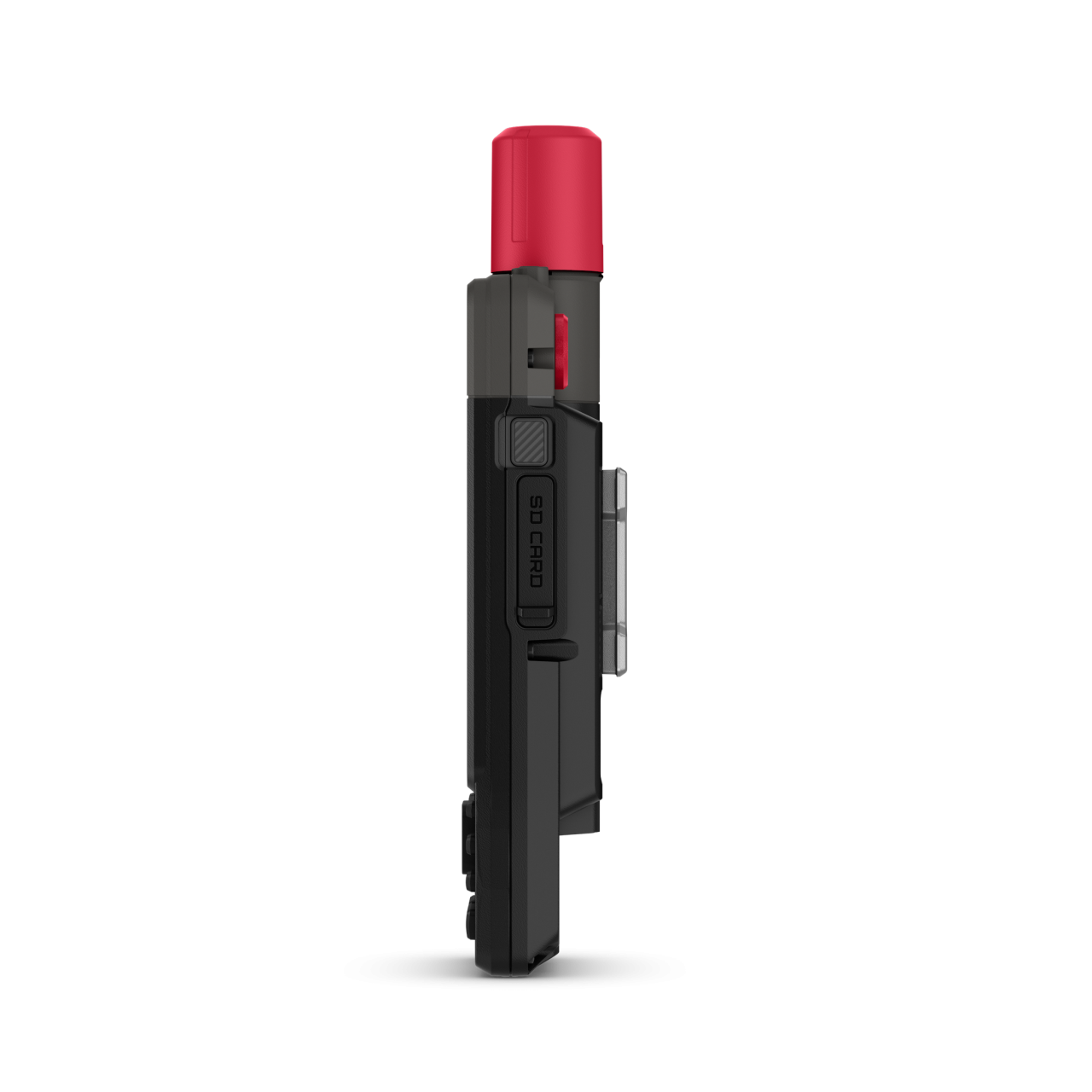
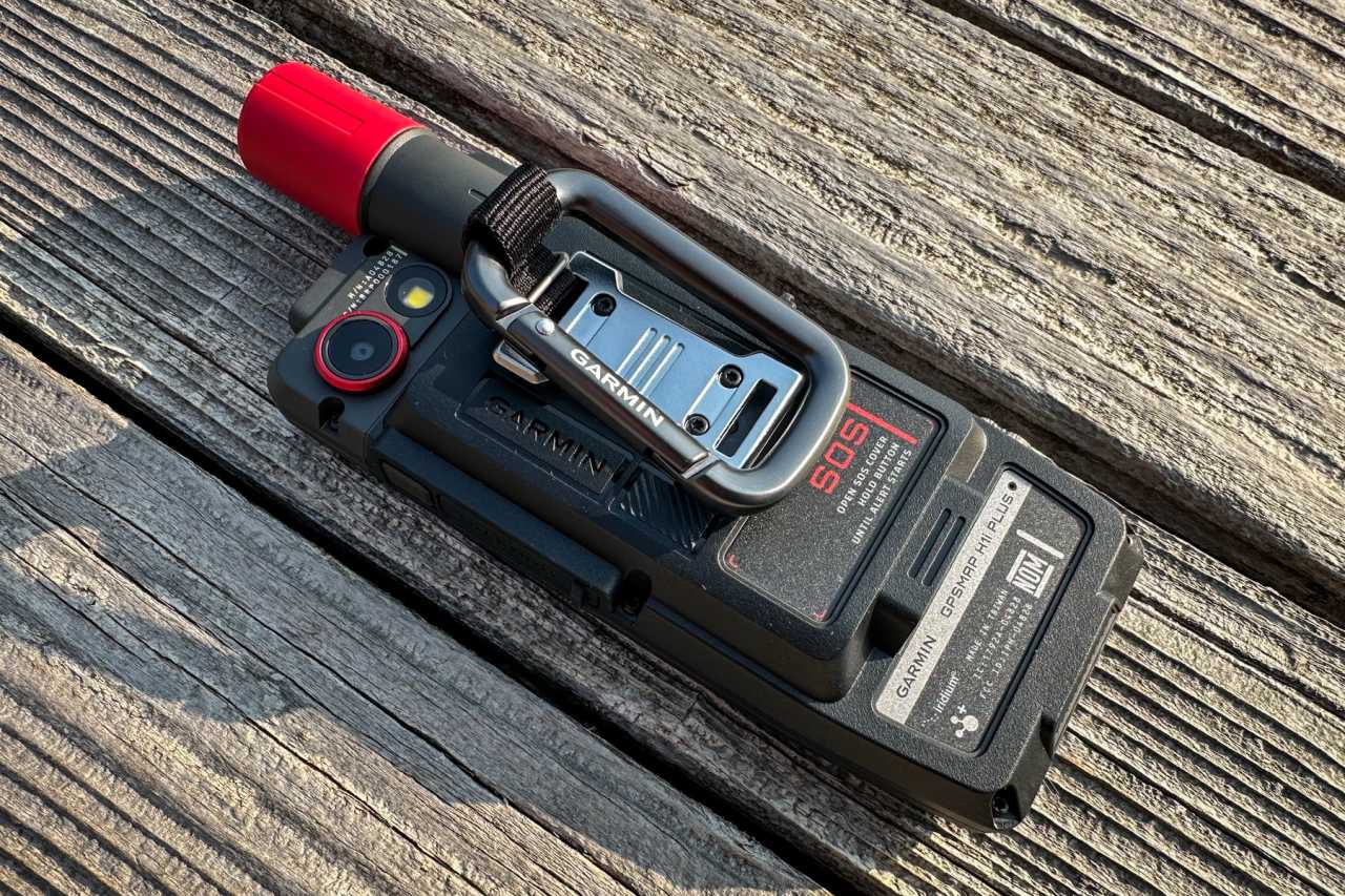
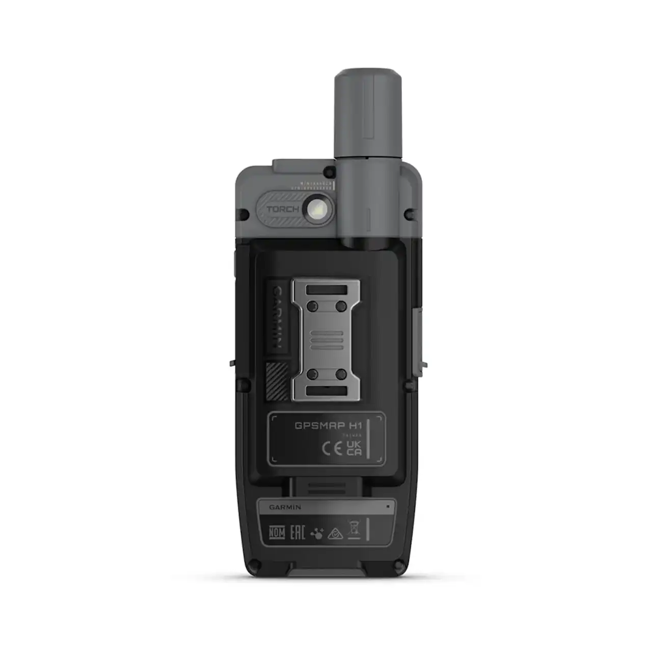
- Although the new Spine Mount 2 system introduced with the GPSMAP H1 is solid (with backpack, bike, and carabiner mounts), not all mount types are available yet (e.g. marine or automotive solutions are still missing). This is a closed Garmin system, protected by patent and tied to licensing.
- The device is also heavier: the GPSMAP H1 weighs 276 g, compared to about 230 g for the previous GPSMAP 67 series. → That’s an extra 40–50 g (roughly the weight of a 250 kcal energy bar) – something to keep in mind when carrying it.
IN MORE DETAIL
The very first GPSMAP device, the GPSMAP 175, was launched in 1996. The concept was simple yet revolutionary: GPS showed precise coordinates, while MAP displayed exactly where you were on the map. From the very beginning, the GPSMAP series became known as a rugged, field-ready, professional navigation tool – indispensable in places with no roads, no mobile coverage, only nature or open water. Its core message has remained the same ever since:
"When safety and accurate positioning can mean saving lives, these devices are the most reliable companions."
Key milestones in development
- GPSMAP 60 (2004) – legendary durability, color display, barometric altimeter and compass, expandable card versions (60Cx/CSx).
- GPSMAP 62 (2010) – BirdsEye™ satellite imagery and photo navigation, USB connectivity, social sharing (Google Earth, Facebook, Twitter), new mounting options (marine, cycling, automotive), 12V connection for boats. Revolutionary accuracy with quad-helix antenna, WAAS/EGNOS correction, and HotFix™ technology.
- GPSMAP 64 (2015) – Bluetooth connectivity and smart notifications, GLONASS support, expanded memory.
- GPSMAP 66 (2019) – larger display, BirdsEye Direct without subscription, Expedition Mode with extra-long battery life, inReach integration in the 66i model (satellite messaging and SOS).
- GPSMAP 65 (2020) – multi-band GNSS reception (GPS + Galileo + GLONASS on multiple frequencies) for even more accurate positioning in challenging terrain.
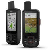
- GPSMAP 67 (2023) – modern hardware, extended battery life, continued inReach support, outdoor focus.
The legacy of physical controls
The GPSMAP series has always emphasized the importance of quick-access physical buttons. Classic models offered dedicated keys for menu, map, zoom, and waypoint saving, ensuring instant operation even in gloves, rain, or snow. The GPSMAP 66 introduced the User key, a customizable button that later inspired the programmable control buttons on Fenix watches.
A turning point: GPSMAP 62
In 2010, the GPSMAP 62 marked a true breakthrough: it was no longer just a rugged GPS, but a genuine “smart” outdoor companion. With new mapping features, BirdsEye satellite imagery handling, and integrated online sharing, it reached a much broader audience. The new mounting options and marine connectivity opened up fresh use cases, while its quad-helix antenna and advanced receiver ensured the most reliable positioning yet.
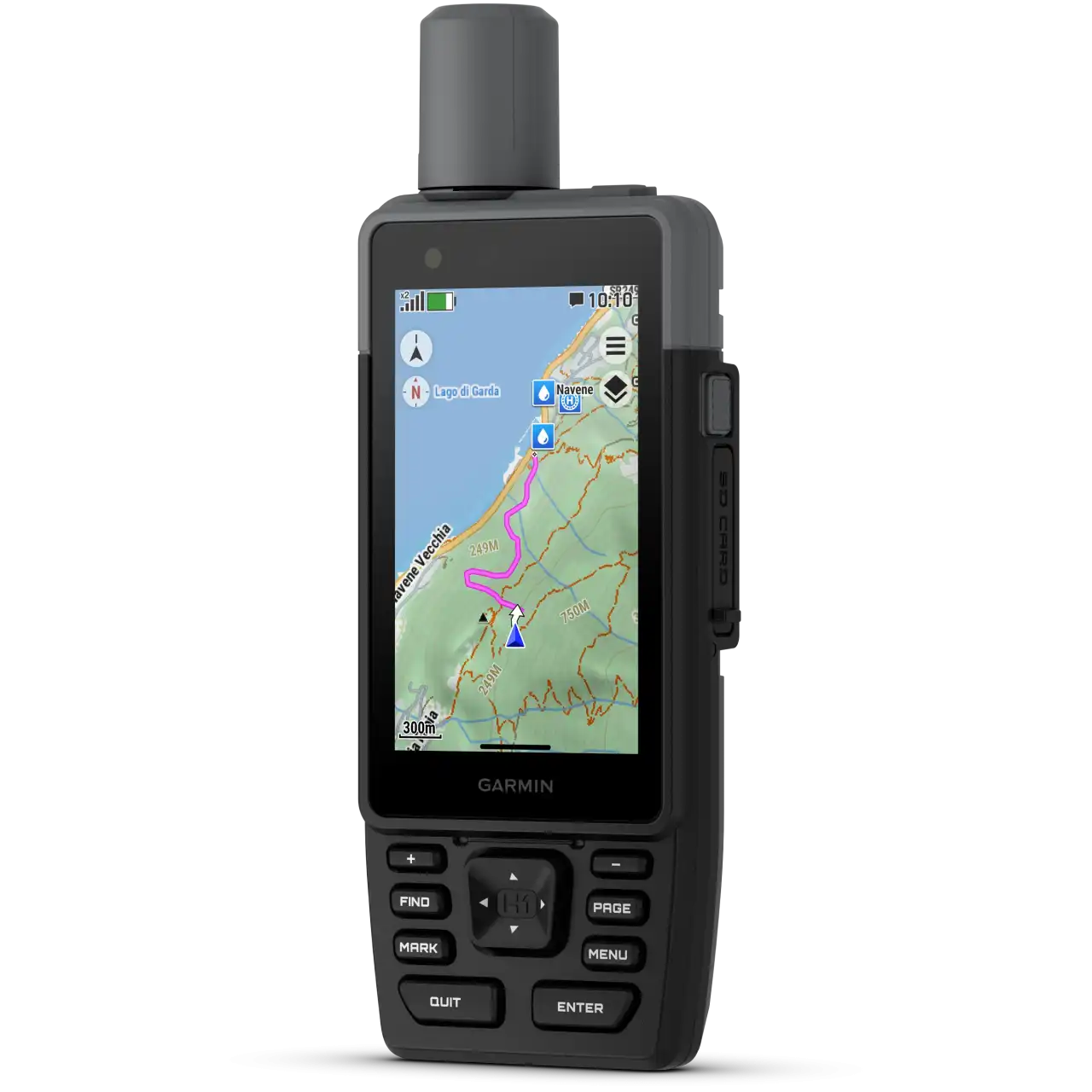
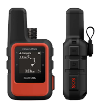
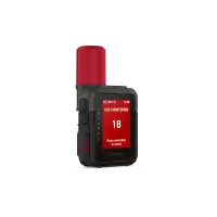
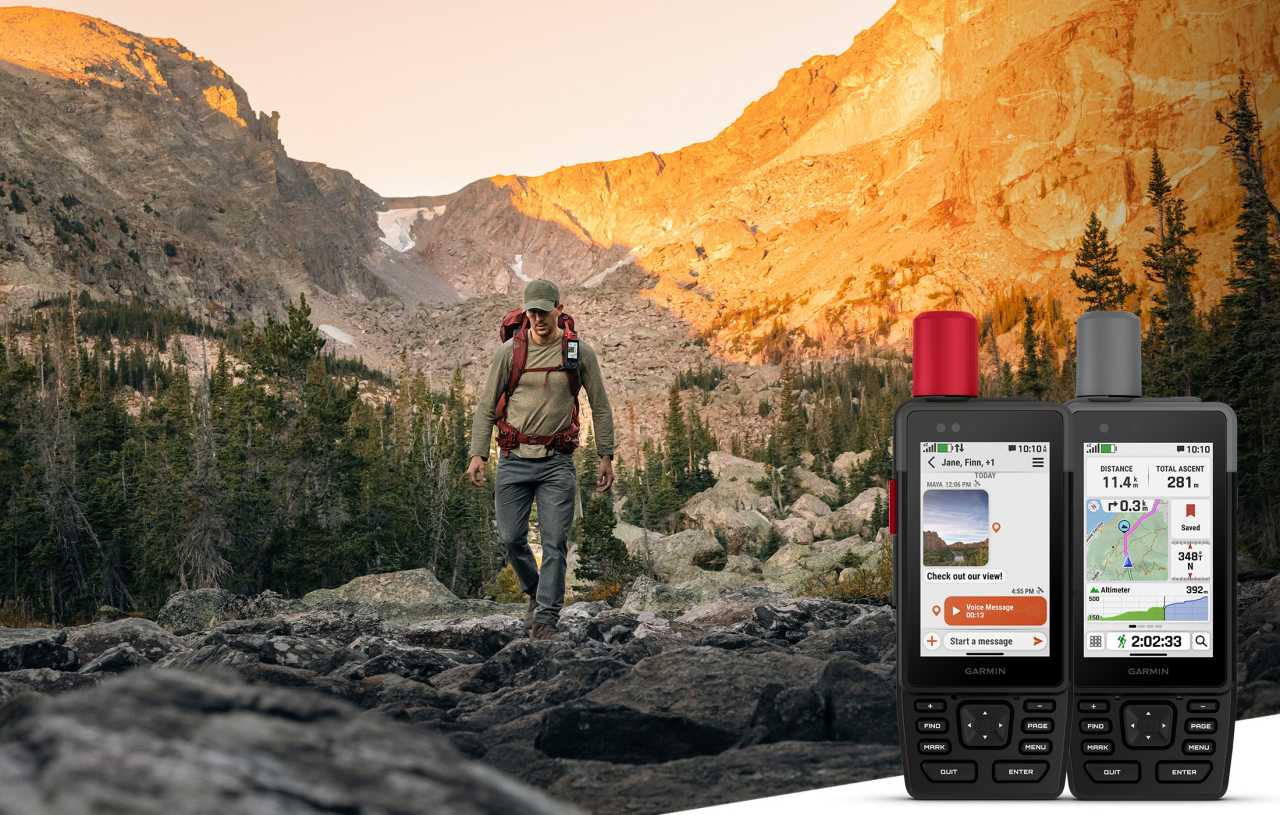
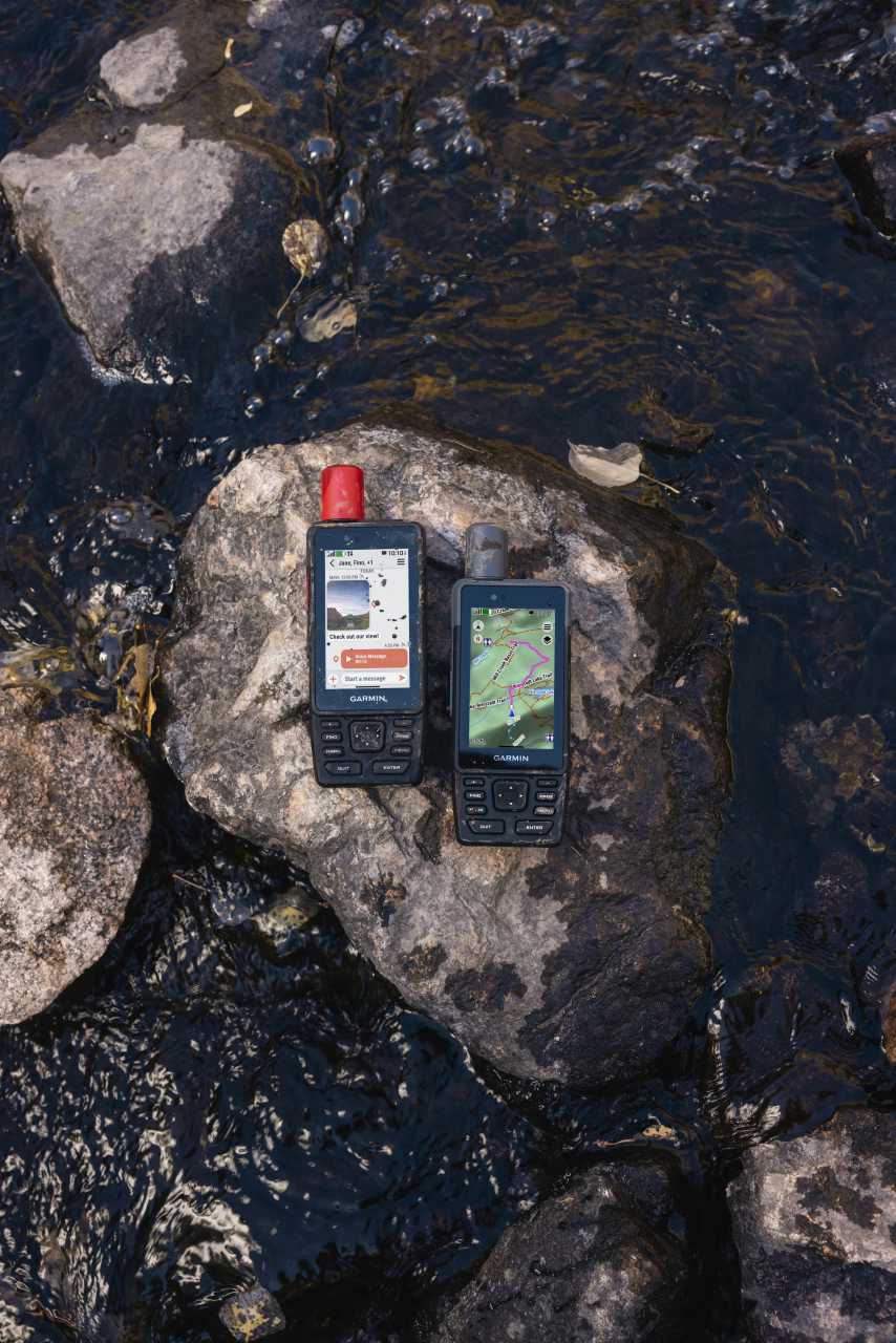
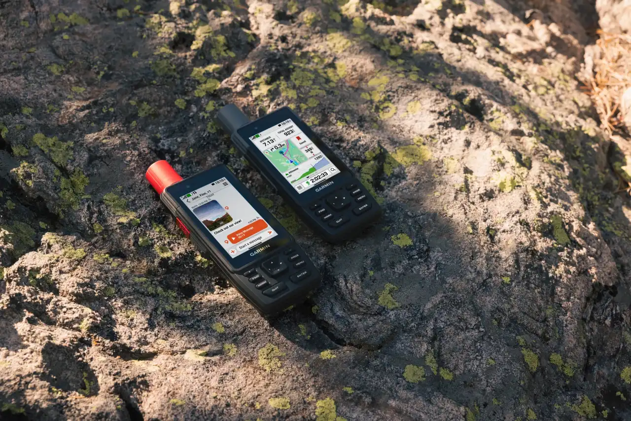
In 2025, the GPSMAP H1 opened a new chapter. It arrived with a completely new design, a 3.5" color display, and added a touchscreen alongside the buttons, plus a camera, photo and voice message sending, two-way satellite communication, and an SOS function. In terms of GPS reception, it didn’t introduce radically new technology, but with the new antenna and modern hardware it finds position much faster and more stably, even during a cold start. The new mounting system also allows more versatile attachment on a backpack, bike, or elsewhere.
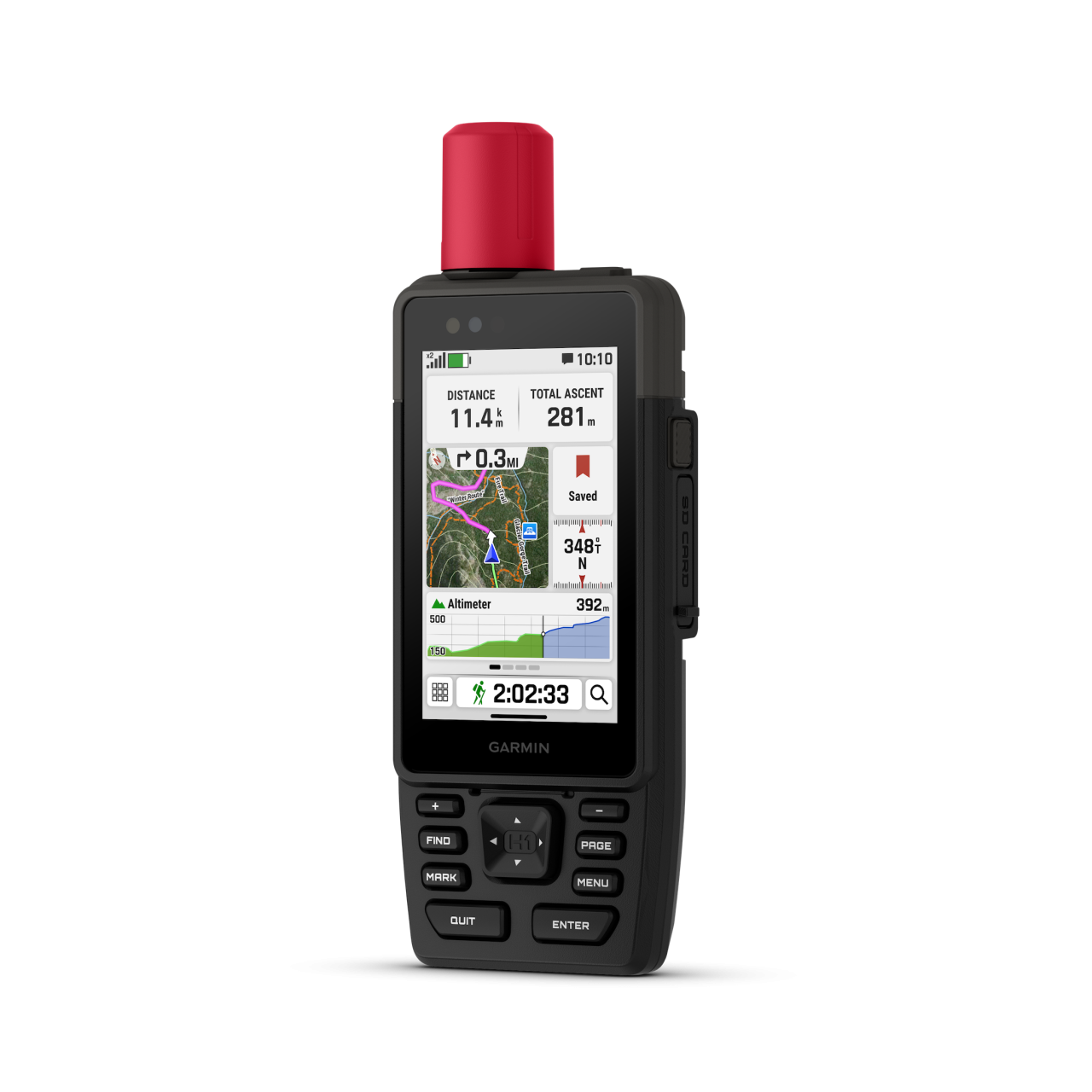
The device marks a new era, with the display increasing from 2.8" diameter to 3.5", which is 1.7× larger in area and uses 3× as many pixels, while also adding a touchscreen alongside the physical buttons. The action button has become multifunctional, preconfigured to access the following functions — fully customizable, of course:
- Tap (short press) → e.g. save waypoint
- Hold (long press) → e.g. siren
- Double tap (two presses) → e.g. flashlight or compass
MOUNTING UPDATE. From 2010 to 2025 Garmin used the Spine Mount (v1) system; now it has moved to the Spine Mount 2 system, Garmin’s proprietary design, which is very convincing in person. Notably, MOLLE-compatible backpack mounting is available — a military standard of horizontal webbing to which pouches, cases, and holders can be attached modularly — and the GPSMAP H1 is compatible with it.
BATTERY LIFE SO HIGH THAT THERE’S ROOM FOR EXTRA FUNCTIONS.
Up to 48 hours in GPS mode (INREACH enabled, 10-minute tracking), 145 hours in GPS mode, and up to 840 hours in Expedition Mode — among the strongest values in its category. The long runtime and efficient power management allowed the GPSMAP H1i Plus to include extra functions such as a built-in flashlight and an emergency siren.
- Flashlight: always at hand, one-button activation, 4 brightness levels and multiple strobe patterns. More practical than a phone light because the device is always with you.
- Emergency siren: instantly activated with the action button; in emergencies it can attract attention, signal your partner, or even deter animals — a practical alternative to a whistle, with a loud, high-pitched tone.
GARMIN MESSENGER. It doesn’t get much attention, so here’s the simple logic:
- If you have mobile data or WiFi → it works like Messenger, WhatsApp, or Viber. You type on your phone and messages go out over the internet.
- If there’s no mobile data but you have an inReach module and subscription → it sends messages via the Iridium satellite network.
- If there’s no internet and no inReach → no messaging.
How do the two devices send messages?
| GPSMAP H1 | GPSMAP H1i Plus |
|
|
Short examples
- In the city: phone + Messenger app → free via WiFi/mobile data.
- In the mountains with no coverage: Messenger app → GPSMAP H1i Plus relays via satellite → deducted from your INREACH subscription.
- If you don’t have your phone: you can type, take photos, and send voice messages directly from the GPSMAP H1i Plus → goes via satellite.
- The GPSMAP H1 cannot do this on its own; it’s for navigation only.
In the simplest terms:
- GPSMAP H1 = professional GPS navigator; it cannot send messages by itself.
- GPSMAP H1i Plus = GPS navigator + built-in satellite communicator; standalone messaging (text, images, voice)
ECOSYSTEM – part of Garmin’s complete system
The GPSMAP H1 and H1i Plus are not only standalone handheld GPS units but also part of Garmin’s full outdoor ecosystem. This means you’re not just getting a device but a complete backend for planning, communication, and mapping.
- Garmin Explore app & web – manage your routes, tracks, and POIs here. Plan your trip on a computer or phone before departure and the device will display it immediately after syncing. One of Explore’s biggest advantages is that it works without coverage: the phone and GPSMAP communicate over Bluetooth, so the track is clear, can be edited or redrawn anytime. You can use your own large database, and every change syncs to the device instantly.
- Garmin Messenger – automatically chooses the best available channel: internet when available, otherwise the inReach satellite network (Iridium). The H1i Plus advantage is its built-in inReach communicator, so it can send text, photos, and voice messages independently — without a phone.
- Outdoor Maps+ subscription – adds extra map layers, e.g., hunting boundaries, waterway charts, forestry roads. Availability varies by country, but it’s available in Hungary and is especially useful for fieldwork, hunting, or watersports.
- Open system – the device can handle dual coordinate systems (e.g., WGS84 and EOV simultaneously) and allows loading community maps such as Turistautak.hu. This is a huge advantage because it lets you complement Garmin’s maps with detailed local datasets.
DIFFERENCES BETWEEN INREACH FUNCTIONS
In 2025, two flagship devices use inReach: the Fēnix 8 PRO watch and the GPSMAP H1i Plus. What are the differences and similarities?
The GPSMAP H1i Plus offers noticeably more reliable inReach communication than the Fēnix 8 Pro.
The difference isn’t whether both support messaging and SOS<span style="font-family: Lato, ui-sans-serif, system-ui, sans-serif, 'Apple Color Emoji', 'Segoe UI
The inReach service is only available on the GPSMAP H1i Plus device, with a monthly subscription. Several packages are available to choose from. The initial activation fee is usually €50. The functions and usage of the inReach packages depend on the selected subscription plan!
Garmin inReach |
|
| Advantages: |
|
| Disadvantages: |
|
MONTHLY FEES
| Plan name | ENABLED (starter) |
The GPSMAP H1 and H1i Plus are made for those who make critical decisions in the field, where human life and safety cannot be in question. They are not chosen by simple hikers, but by users who work or move in extreme environments. For rescue services, mountain rescue teams, foresters, researchers, and conservation professionals, the device is part of daily work, as it provides accurate track and waypoint documentation, as well as reliable communication even where no mobile network is available. Hunters, high-altitude trekkers, mountaineers, and water sports enthusiasts use it because they can rely on it under extreme conditions, whether for barometric altitude measurement, climb pro elevation preview, or waterproof construction. Off-road motorcyclists and 4x4 drivers use it for field navigation and safe return. In short: the GPSMAP series begins where hobby ends – and where reliability can quite literally mean life or death.
When should you choose the GPSMAP H1?
If your primary need is navigation, mapping, track recording, and extreme battery life, but satellite messaging is not essential for you. The H1 is the perfect companion for hikes, hunts, off-road adventures, or research work where communication can be handled in other ways (e.g. by mobile phone).
When should you choose the GPSMAP H1i Plus?
If in addition to navigation you also need built-in inReach satellite communication, and you want to send/receive text messages, photos, and voice messages even without coverage or mobile data. The H1i Plus provides complete independence in the field: SOS alerts, messaging, and location sharing are all possible without a phone.
2025.10.25. – Zerge
This concludes our own opinion; below you can read the official description from the manufacturer. From the above, however, you can already see that the GPSMAP H1 and H1i Plus go far beyond a traditional handheld GPS. On our website, the Specifications tab receives special attention – here you can compare the most important functions, organized around real user needs.
WHEN ADVENTURE CALLS, RESPOND
This rugged handheld GPS has a modern design, preloaded maps and built-in inReach® Plus technology1 to stay in touch beyond mobile network coverage. It’s time to hit the trails.

HYBRID DESIGN OFFERS A 3.5″ COLOUR TOUCHSCREEN AND PHYSICAL BUTTONS

EXCHANGE PHOTOS, VOICE MESSAGES AND TEXT MESSAGES WITH AN INREACH SUBSCRIPTION1

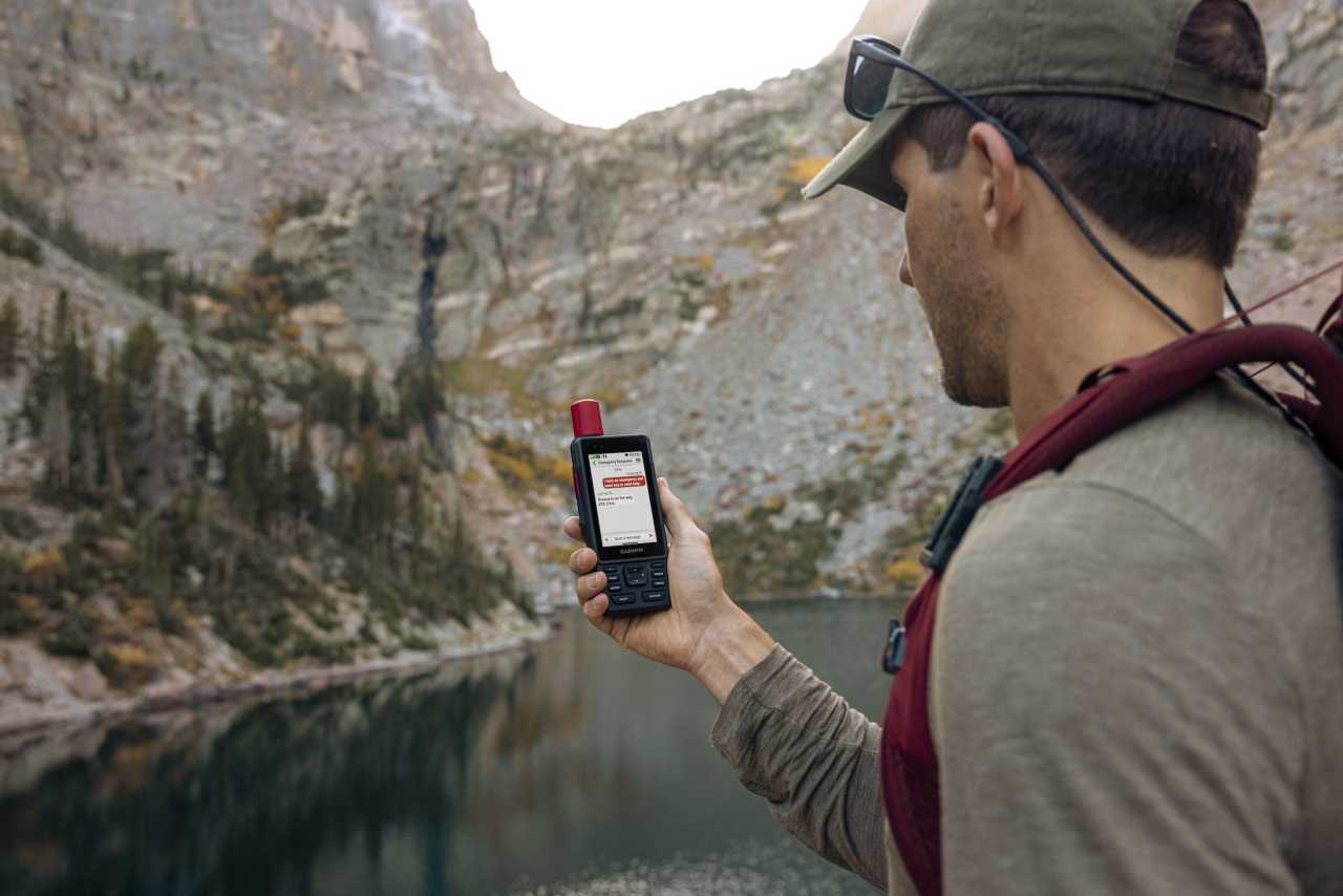
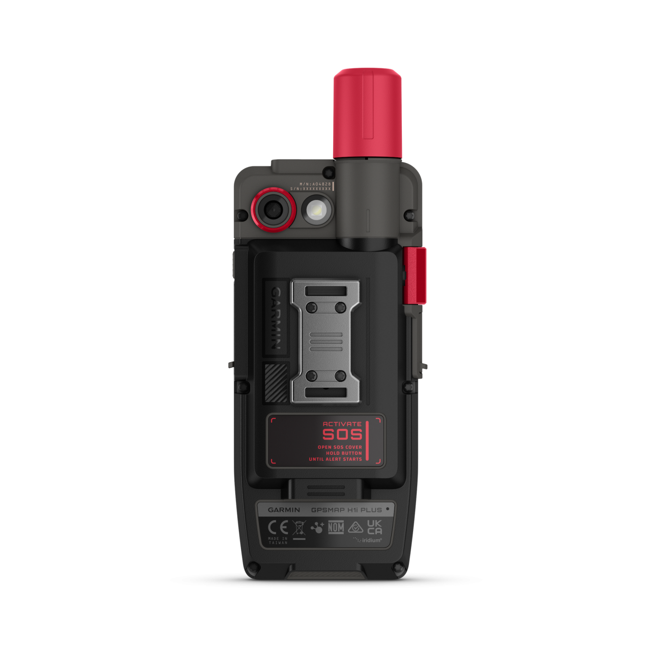
SEND AN SOS MESSAGE TO THE GARMIN RESPONSE℠ CENTRE FOR HELP IN AN EMERGENCY (SUBSCRIPTION REQUIRED)

PRELOADED TOPOACTIVE MAPS, DOWNLOADABLE SATELLITE IMAGERY AND OPTIONAL OUTDOOR MAPS+ CONTENT

LONG BATTERY LIFE OFFERS UP TO 145 HOURS IN GPS MODE

MULTI-BAND GPS AND MULTI-GNSS SUPPORT HELPS PINPOINT YOUR PRECISE LOCATION
| WHAT YOU'LL LOVE | ||

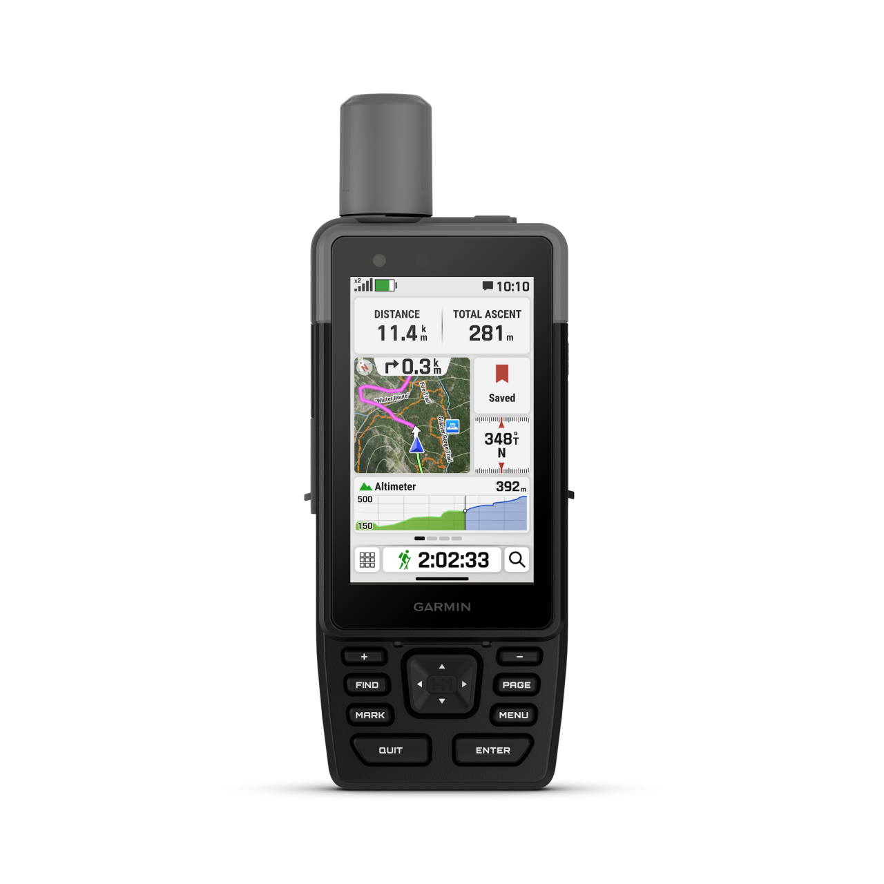
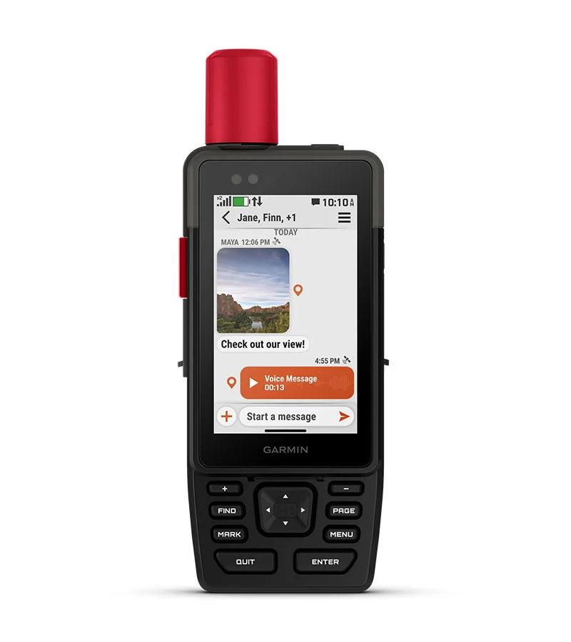
Touchscreen Display
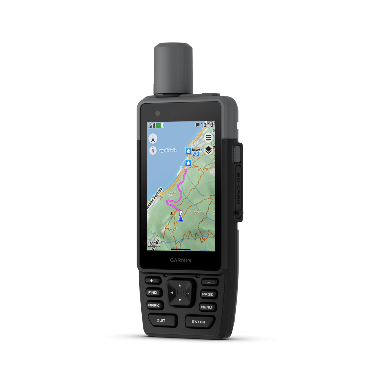
The bright, sunlight-readable 3.5″ colour touchscreen has chemically strengthened glass to resist scratches. It is glove-friendly, easy to see and easy to use. Tap, zoom and swipe on the maps to follow your route.
PHYSICAL BUTTONS
The rugged hybrid design also features intuitive push buttons for more versatility when in weather and while wearing gloves. The quick-action button lets users customise functions to their specific needs.
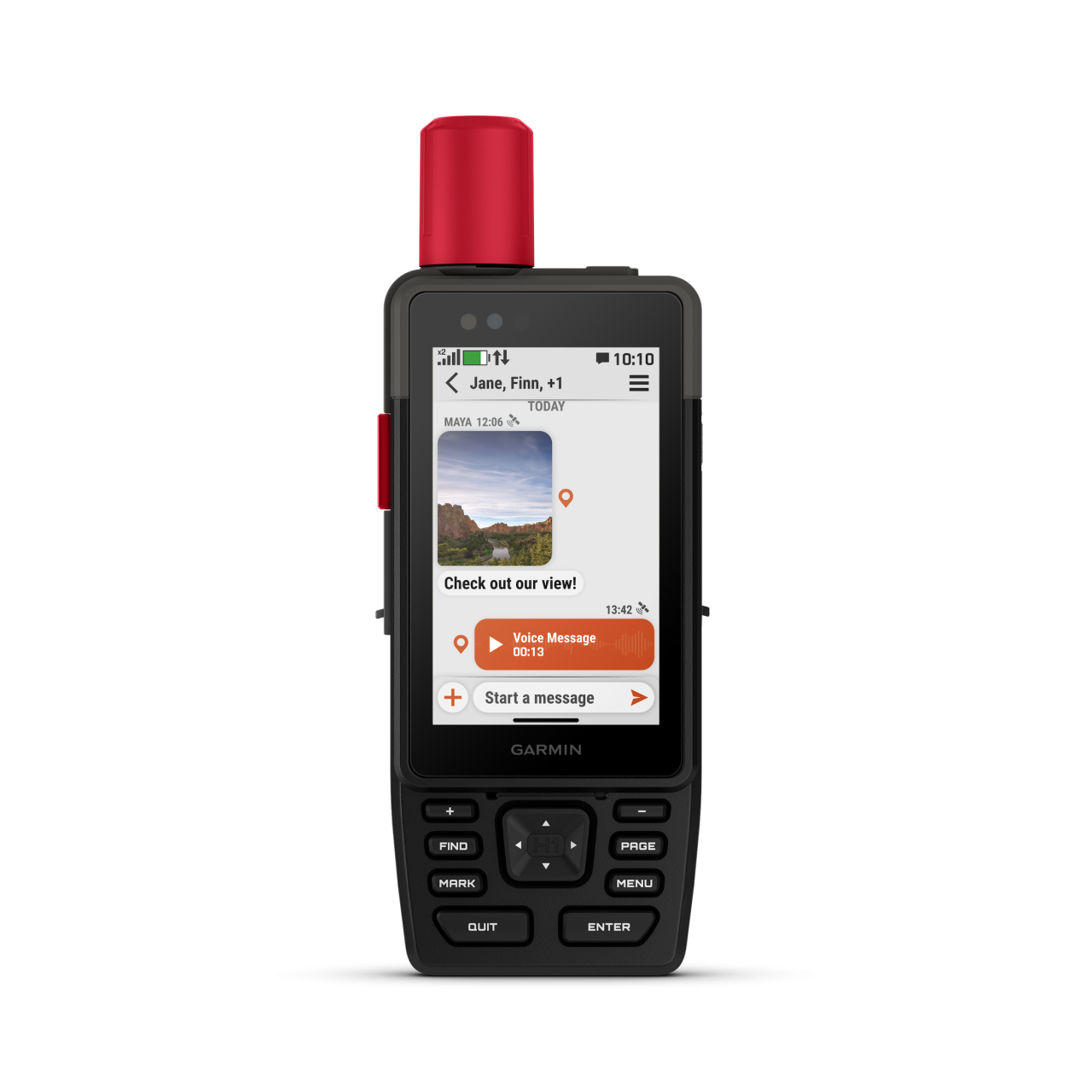
PHOTOS AND VOICE/TEXT MESSAGING
With an active inReach subscription1, send group text messages up to 1,600 characters. You can also exchange photos and voice messages when outside of mobile network coverage.
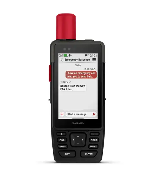
SOS ALERTS
Trigger an interactive SOS message anytime to the 24/7-staffed Garmin Response international coordination centre for help in an emergency. This requires an active inReach subscription1.
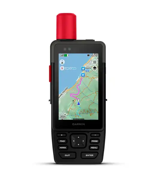
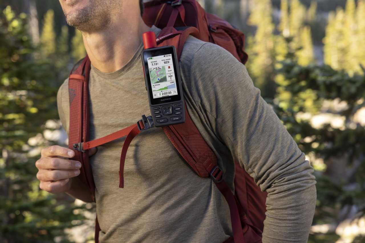
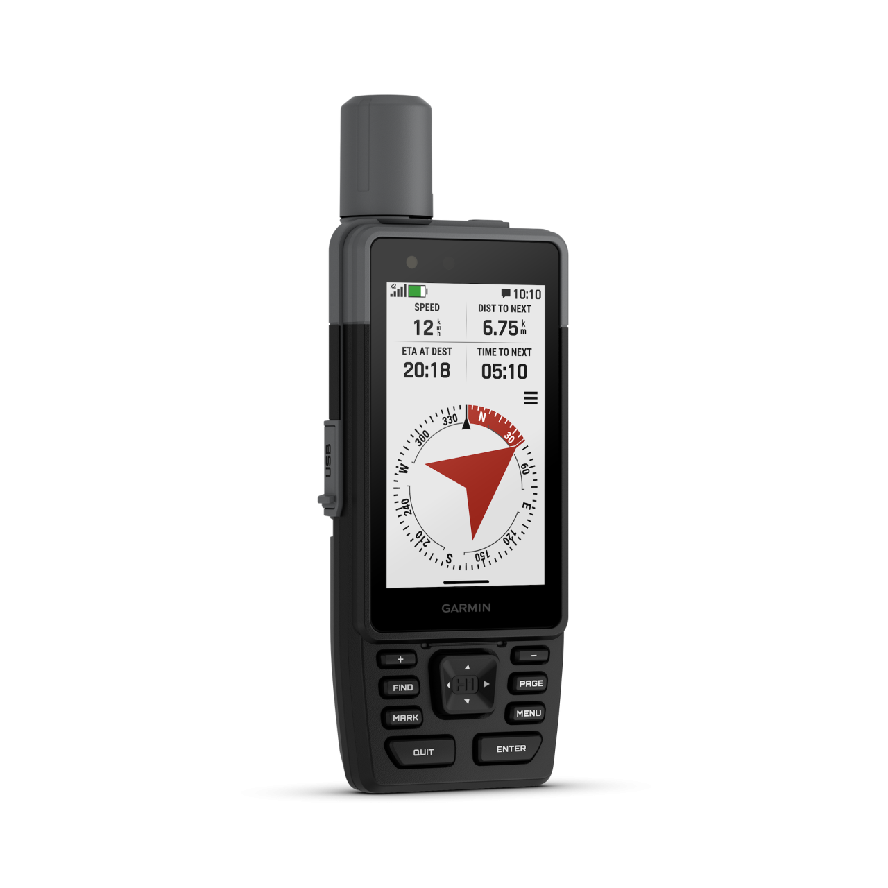
Advanced Navigation
Navigate with preloaded TopoActive maps for the Europe, Middle East and Africa — and easy-to-access global maps. See terrain contours, elevations, geographical points and more.
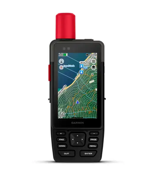
SATELLITE IMAGERY
Download high-resolution photorealistic maps directly to your device via Wi-Fi® technology. Find trails, pick stand locations and parking, create waypoints and more.
| BUILT FOR ADVENTURE | ||
KNOW THE UNKNOWN


OUTDOOR MAPS+
Purchase an Outdoor Maps+ plan for access to a variety of premium mapping content across the globe. Plans are updated regularly and sent to your device over Wi-Fi.
LOCATION ACCURACY
Get multi-band GPS and multi-GNSS support for superior positional accuracy.
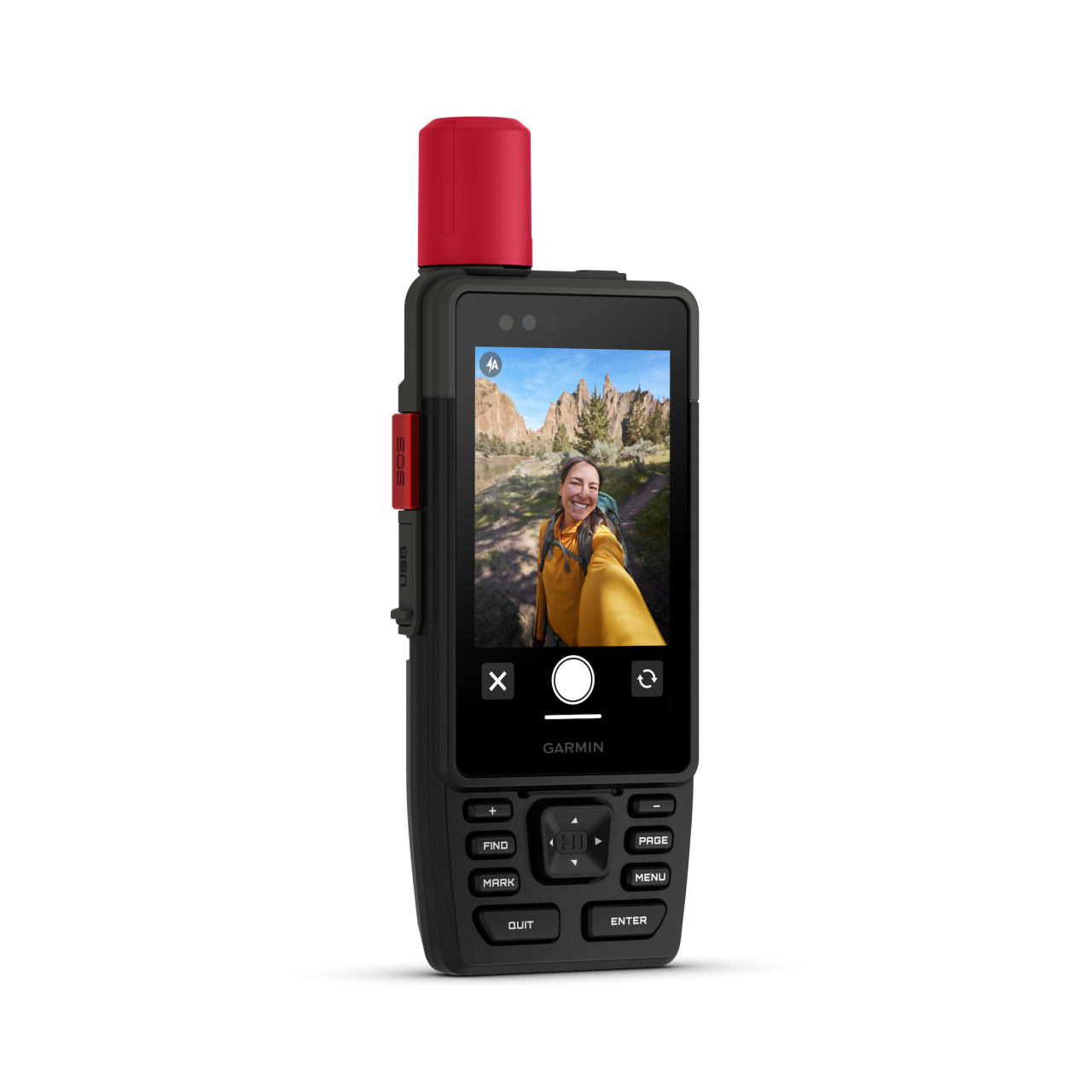
BUILT-IN CAMERAS
The integrated front and back cameras allow you to snap selfies and photos of your trip. With an active inReach subscription1, share your photos in real time even without a mobile network.
VOICE CONTROL
Utilise voice commands to conveniently handle many tasks, including check-ins, start tracking, take a photo and more. Available in Danish, Dutch, English, French, German, Italian, Spanish and Swedish.
LIVETRACK™ SHARING
When you venture off-grid, friends can follow along via satellite technology1 to view your progress, ping your device to see your GPS location and exchange messages. For trips within mobile coverage, loved ones can follow your location in real time and see data such as distance, time and elevation.


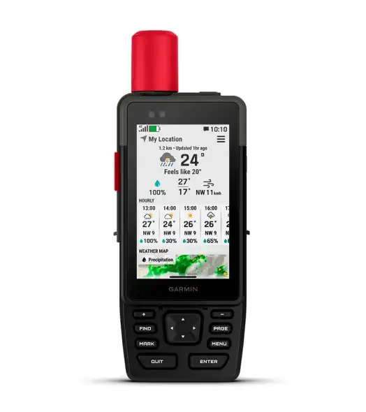
GARMIN WEATHER
Get real-time forecast information so you’re aware of the changing conditions. This feature requires an active Wi-Fi connection or an active cellular connection and use of the Garmin Messenger™ app on your paired smartphone. When you travel beyond mobile coverage, access weather updates via satellite1 for your current location, route destination and more.
PLAN YOUR TRIPS
Enjoy seamless trip planning with the ability to easily locate geographic points, share your route and more. This requires an active Wi-Fi connection or cellular connection with use of the Garmin Explore™ app on your compatible smartphone.
EVOLVED DESIGN


HELPFUL TOOLS
Use the built-in bright LED flashlight torch as a beacon or to light your way when the path goes dark. A loud built-in siren can help draw attention if you are in need.
BATTERY LIFE
Long-lasting battery life allows for up to 145 hours in GPS mode.
RUGGED DESIGN
Built to meet MIL-STD 810 for thermal, shock, water (IPX67) and vibration to withstand weather and extreme temperatures.
ON THE GO
This device has an integrated Spine Mount 2 and includes a removable loop with carabiner clip for more versatility on your adventure. It’s also compatible with additional Spine Mount 2 accessories, sold separately.
ABC SENSORS
Get a built-in altimeter for elevation data, a barometer to monitor weather and a 3-axis electronic compass to provide direction.
|
1Satellite subscription required. Some jurisdictions regulate or prohibit the use of satellite communication devices. It is your responsibility to know and follow all applicable laws in the jurisdictions where the device is intended to be used. 2Requires an active cellular connection and use of the Garmin Messenger app on your paired smartphone Wi-Fi is a registered trademark of the Wi-Fi Alliance. Engineering enhancements are ongoing and may not be reflected in the pictures, videos and specifications. |
||
.png)