GARMIN Dakota 20

010-00781-01

This rugged, palm-sized navigator combines touchscreen navigation, high-sensitivity GPS with HotFix® satellite prediction, barometric altimeter, 3-axis electronic compass and microSD™ card slot in one affordable, power-packed punch.

Discontinued product.
SPECS

Technical specifications

Button lock or Locking the Touchscreen

CLOCK MODE

12/24h
Calendar clock

HEART RATE MONITOR CHEST STRAP

2.4 GHz – coded transmission
Coded heart rate signal
User replaceable battery
Textile comfortable heart belt
vásárlástól függ

PRE-TRAINING FUNCTIONS

Sports profile settings
Pulse zone settings
nem
Adjustable recording rate
automata

COMPUTER CONNECTIVITY

Data transmission device in the package?
Driver Name
Garmin Express
Compatible with PC
Compatible with Mac
Hungarian-language software

NAVIGATION FEATURES

Displays the coordinates
Track and POIs on display at the same time
Can be filled from the GPS Trace
Routes
50
Show the map on device
zoom in or out
database of maps

GPS FUNCTIONS

Tide database
Sun and moon information
Area calculation
Outdoor GPS games

Image and video settings

image Stabilizer

Video

Video mode
1080p 30fps (1920×1080), 720p vagy WVGA
Loop function (continuous loop recording)
video replay

CYCLING cadence sensor

Bike cadence sensor
csak a GSC10 GSC10, de nem jegyzi, csak jelzi
Number of hours taught-cadence
1

ALTIMETER FEATURES

Altimeter, Total Ascent
Total Descent
external wireless temperature sensor (garmin tempe)

HUNTING & FISHING

Hunt/fish calendar
Description

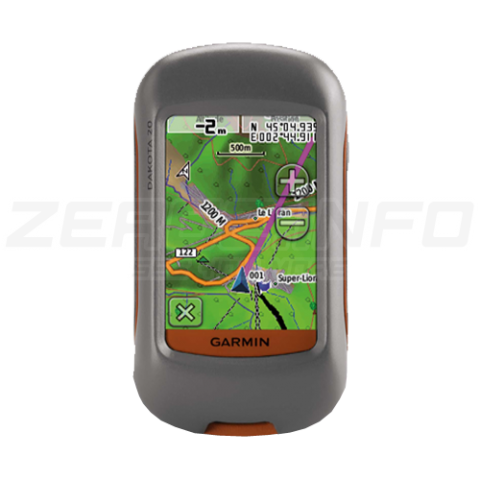
GARMIN DAKOTA 20


Outdoor navigation meets touchscreen simplicity in Dakota 20. This rugged, palm-sized navigator combines touchscreen navigation, high-sensitivity GPS with HotFix® satellite prediction, barometric altimeter, 3-axis electronic compass and microSD™ card slot in one affordable, power-packed punch.
Touch and Go

Dakota 20 makes outdoor navigation effortless with a tough, sunlight-readable, 2.6" (6.6 cm) color touchscreen display. The interface is easy to use, so you’ll spend more time enjoying the outdoors and less time searching for information. Both durable and waterproof, Dakota 20 is built to withstand the elements; bumps, dust, dirt and water are no match for this rugged navigator.
Get Your Bearings
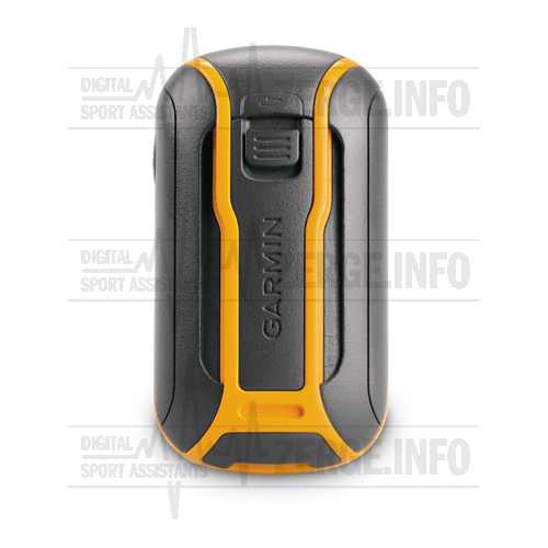
 

garmin_dakota10_back

Dakota 20 has a built-in 3-axis electronic compass, which shows where you're heading even when you’re standing still or not holding the device level. Its barometric altimeter tracks changes in pressure to pinpoint your precise altitude, and you even can use it to plot barometric pressure over time, which can help you keep an eye on changing weather conditions. And with its high-sensitivity, WAAS-enabled GPS receiver with HotFix satellite prediction, Dakota 20 locates your position quickly and precisely and maintains its GPS location even in heavy cover and deep canyons.
Find Fun

Get into paperless geocaching with Dakota 20 by quickly downloading up to 2,000 caches with information such as location, terrain, difficulty, hints and description — no more paper print outs and manually entered coordinates! Visit our geocaching pages for more information.
Explore the Terrain

Dakota 20 comes with a built-in worldwide basemap, so you can navigate anywhere with ease. Adding more maps is easy with Garmin's wide array of detailed topographic, marine and road maps, available on microSD card.
Share Wirelessly

With Dakota 20 you can share your waypoints, tracks, routes and geocaches wirelessly with other compatible Dakota, Foretrex®, Oregon® and Colorado® users. Now you can send your favorite route or geocache location to a friend easily. Just touch "send" to transfer your information to similar devices.
Get Connected
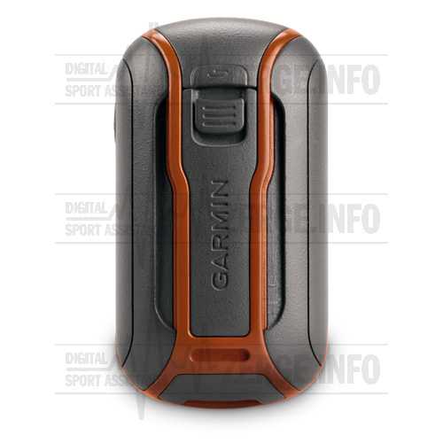
 

garmin_dakota20_back


You've been busy exploring and now you want to store and analyze your activities. With a simple connection to your computer and Internet, you can get a detailed analysis of your activities and send tracks to your outdoor device using Garmin Connect™. This one-stop site offers an activity table and allows you to view your activities on a map using Google™ Earth. Explore other routes storage/files/uploadsed from more than 12 million customers and share your experiences on Twitter® and Facebook®. Getting started is easy, so get out there, explore and share.
Plan Your Next Trip

Take charge of your next adventure with BaseCamp™, software that lets you view and organize maps, waypoints, routes, and tracks. This free trip-planning software even allows you to create Garmin Adventures that you can share with friends, family or fellow explorers. BaseCamp displays topographic map data in 2-D or 3-D on your computer screen, including contour lines and elevation profiles. It also can transfer an unlimited amount of satellite images to your device when paired with a BirdsEye Satellite Imagery subscription.
In the box / Warranty

WHAT'S IN THE BOX?

  • Dakota 20
  • Lanyard
  • USB cable
  • Manuals
  • NaviGuide Hungary Map or TopoGuide Hungary Map
Accessories

Product accessories

Bryton Smart Dual Sensor

BRYTON Magnet-Less Dual Speed/Cadence Sensor

Bryton Smart Cadence Sensor

BRYTON Magnet-Less Dual Cadence Sensor

Wahoo RPM Cadence & Speed sensor

A low profile, magnet-less, wireless solution for tracking cycling SPEED and cadence via a Bluetooth...

Wahoo RPM Speed Sensor

A low profile, magnet-less, wireless solution for tracking cycling SPEED and cadence via a Bluetooth...

Wahoo RPM Cadence Sensor

A low profile, magnet-less, wireless solution for tracking cycling cadence via a Bluetooth Smart or...

Garmin DUAL Bike Speed and Cadence Sensor

Monitor your pedaling cadence and/or speed as you ride with these easy-to-install wireless sensors.

Wahoo RPM cadence mount kit

A low profile, magnet-less, wireless solution for tracking cycling cadence via a Bluetooth Smart or...

iGPSPORT CAD70 CADENCE SENSOR

iGPSPORT Magnet-Less Dual Cadence Sensor

iGPSPORT SPD70 Speed Sensor

iGPSPORT Magnet-Less Dual Speed Sensor

Garmin Handlebar Bike Mount

Take your compatible outdoor device to the streets or the trail for fitness use. Just snap your devi...

Garmin Swivel Belt Clip

Keep your Garmin GPS unit in reach while on the move with this belt clip. Your GPS unit fits securel...

Garmin Belt Clip (Spine Mount)

Buy Garmin Belt Clip for Select Garmin Devices features Compatible with Many Garmin Devices,

Garmin Backpack Tether GPS Holder Mount Bracket

This lightweight backpack tether is perfect for conditions that demand

Carabiner Clip Garmin

Carabiner Clip. To download this product, you'll need Garmin ...

Gembird® USB 2.0 A -> USB 2.0 mini 0,3 meters cable

Gembird® USB 2.0 A -> USB 2.0 mini B 5pin M/M data cable 0,3m black

Garmin VÍVOsmart 5

A physical activity bracelet with built-in heart rate monitoring that has all of Garmin's health mon...

Similar products

Similar products

Garmin eTrex 32X

Explore confidently with the Garmin eTrex 32x handheld GPS featuring a compass, altimeter, preloaded...

Garmin GPSMAP® 67 series

You love exploring the outdoors. You need a handheld GPS with long battery life and our most accurat...

SUPPORT
Other: