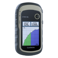
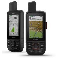
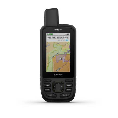
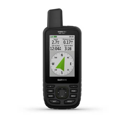
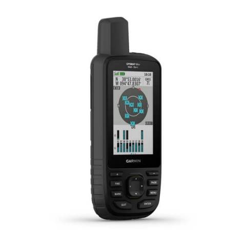
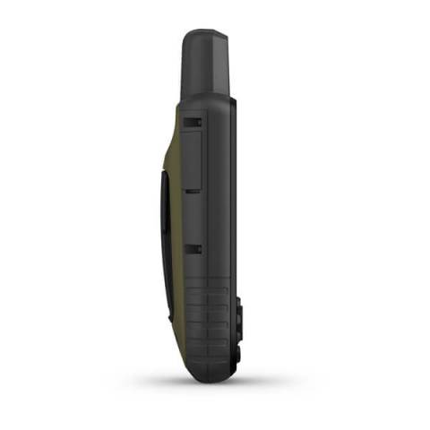
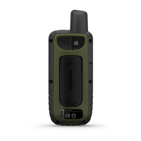
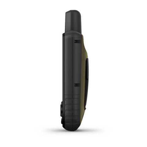
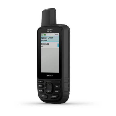
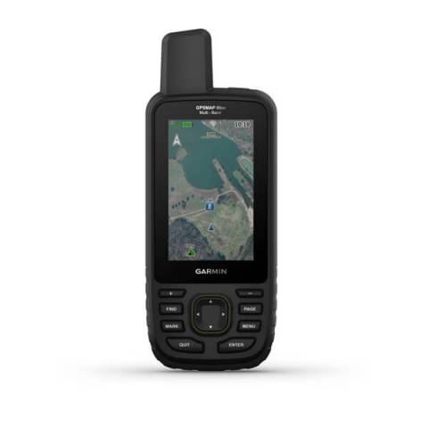
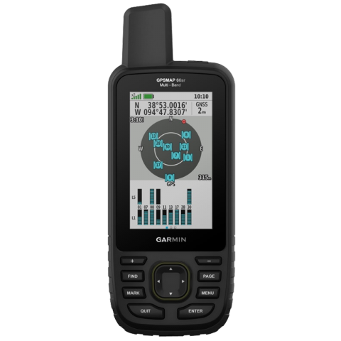
GARMIN GPSMAP 66sr

010-02431-01

Multi-Band/GNSS Handheld with Sensors and TOPO Maps

Unpack your new device with the display already perfectly protected. The price includes the protective cover/foil.

ClearPlex protection and installation_ikon

Careful implementation of the requested service can be time-consuming. Due to the service you have chosen, delivery may be one working day later than the delivery method you have selected. Thank you for your understanding.

Forgalomból kivont.
SPECS

Overview

Short summary
Expanded GNSS handheld with sensors and TopoActive Europe maps

TECHNICAL DETAILS

BRAND
GARMIN
BRAND
USA
Made in
TAIWAN
Year of manufacture
2020
Registration required (cloud based)
Weight
230 gramm
Unit dimensions, WxHxD:
6,2 x 16,3 x 3,5 cm
Display size:
38 x 63 mm
Display resolution
240 x 400 pixels
Display Type
transflective color TFT
Battery
Rechargeable, internal lithium-ion
Low battery warning
Operating temperature range
-20° to 45°C
Guarantee or warranty ( for person )
2 years
Guarantee or Warranty (for company)
1 year

Training goal/ exercise motivation (Best = XXXXX)

Performance-enhancing training
XX
Health care
XXXXX
Good feeling exercise
XXXXX

Battery Life (Accu)

GPS mode
36 hours
Expedition GPS activity
Up to 200 hr.

Technical specifications

Release date
AUG 2020
No longer available.
JUL 2023
Average service time (my own experience)
1-5 nap
Waterproof
Device menu in Hungarian
Backlight
Bulilt-in LED flashlight
Gloves to handle
During use, the battery can be charged
Memory Capacity
16Gbyte
Software Upgrade
Factory reset
menu -> menu -> setup -> reset

CLOCK MODE

12/24h
UTC
GPS time synchronization
Calendar clock
Sunrise sunset times
Countdown

HEART RATE MEASUREMENT

Current heart rate
only with heart rate monitor

HEART RATE MONITOR CHEST STRAP

Package is the heart rate strap?
no
ANT + compatible
2.4 GHz – coded transmission
Coded heart rate signal
Memory function
only HRM-SWIM, HRM-TRI, HRM-PRO, HRM-PRO Plus

PRE-TRAINING FUNCTIONS

Sports profile settings
Customizable screen(s)
Automatic start, stop, pause recording

SETTINGS DURING TRAINING

Graphical target zone indicator

SETTINGS AFTER TRAINING

Wi‑Fi® Connected Features
Total history
WIFI (upload an activity wirelessly)

SMARTPHONE FUNCTION

Shows shows current weather widget
APP name
Garmin Explore
Android phones
7.0 android és későbbi
Smartphone Compatible
iOS 13 or higher
Notifications on the watch
call acceptance / rejection / recall

SAFETY FEATURES (Smartphone required)

LIVE TRACKING

COMPUTER CONNECTIVITY

Data transmission device in the package?
Data transfer device name
Mini USB
RINEX Logging (Receiver Independent Exchange Format)
Driver Name
Garmin Express
Compatible with PC
Compatible with Mac
Session-level data show
Graphical visualization exercise
Hungarian-language software

3rd PARTY APP

Data export (.gpx, .tcx, .csv)

NAVIGATION FEATURES

Map receiving
Preloaded maps
Topo Active Europe
Lifetime GPS map updates
Map orientation
nothh up or heading
Find the starting point
Displays the coordinates
EOV coordinates
Waypoints/favorites/locations
10000
Track and POIs on display at the same time
Lock on road
Can be filled from the GPS Trace
Route and elevation profiles
Routes
250
Geocaching-friendly
Show the map on device
zoom in or out
Scanning
database of maps
Retaining Zoom
3-D terrain view

GPS FUNCTIONS

GPS (USA) satellite system compatible
GLONASS satellite system compatible (30cm Accuracy!)
GALILEO
Multi-GNSS
Multi-Band GNSS
built-in Memory
16 GB
Tide database
Sun and moon information
Area calculation
Training computer displays the Route
Expandable data card
igen, microSD (max 32GB)
Unit-to-unit transfer (shares data wirelessly with similar units)

inReach® features (requires subscription)

inReach remote compatible

CYCLING speed sensor

Package is the speed sensor?
no
ANT+ compatible

CYCLING cadence sensor

ANT+ compatible
Package is the cadence?
no

Boating Features

MOB

ALTIMETER FEATURES

Altimeter, Total Ascent
Total Descent
barometer
Automatic Alti/Baro switch
bulit in temperature sensor
external wireless temperature sensor (garmin tempe)
Altitude alerts
storm alarm
Compass
3D digital compass
Vertical ascent in meters per hour
Altitude, ascent and descent – meters, degrees, percentage

Tactical features

MIL-STD-810G tests
Dual grid coordinates

PACKAGE CONTENTS

Computer
Description

GARMIN GPSMAP 66sr


Premium GPS handheld with BirdsEye satellite imagery subscription

  • Large, 3" sunlight-readable colour display for easy viewing
  • Multiple Global Navigation Satellite Systems (GNSS) support to track your travels in more challenging environments than GPS alone, plus three-axis compass and barometric altimeter
  • Access to BirdsEye satellite imagery with direct-to-device downloads and no annual subscription, and preloaded TopoActive European maps
  • Expanded wireless connectivity supports Active Weather for up-to-date forecasts and animated weather radar, and Geocaching Live for mobile syncing and updates
  • Compatible with Garmin Explore™ website and app to help you manage tracks, routes and waypoints, and review statistics from the field
  • LED flashlight function plus up to 16 hours of battery life in GPS mode and 1 week in expedition mode for fewer charges


Navigate your next outdoor adventure with the GPSMAP 66 series. Whether you're hiking, mountain biking, climbing, geocaching, kayaking or working in outdoor environments, you can explore more with this iconic rugged handheld with a 3" colour display. It offers a new quality of positioning with Quad-Helix antenna performance and multi-satellite support as well as wireless connectivity for Active Weather, direct downloads and Garmin Explore compatibility.


Get your bearings
In addition to multi-GNSS support, the GPSMAP 66 series provides ABC (altimeter, barometer and compass) sensor capabilities to track your journey. The built-in altimeter provides elevation data to accurately monitor ascent and descent, while the barometer can be used to predict weather changes by showing short-term trends in air pressure. The three-axis electronic compass keeps your bearing whether you're moving or not.


See where you're headed
Get a better picture of your location with high-resolution photo-realistic views of your route, thanks to direct-to-device downloads of BirdsEye satellite imagery — without an annual subscription. You'll see a true representation of your surroundings to find trails, trailheads and clearings for campsites, to find parks and parking for geocaching, and even to create waypoints based on landmarks.


Stay tuned to conditions
You’ll always stay informed of weather conditions when you pair your GPSMAP 66 series device via Bluetooth® to a compatible smartphone. Receive Active Weather updates for real-time forecast information, including predictive maps for temperature, wind, precipitation and clouds. It also provides live weather radar so you’re aware of inclement weather that can affect your outdoor adventures.


Find your cache
GPSMAP 66s and GPSMAP 66st devices make it easier than ever to enjoy your geocaching experience. Set it to automatically update with all the latest caches from Geocaching Live, including cache descriptions, logs and hints. With a Wi-Fi® connection or through Garmin Connect™ on a compatible smartphone, you'll avoid manually entering coordinates or printing out cache details on paper — and each find will automatically storage/files/uploads to your Geocaching.com profile.


Explore with Garmin
Even when you're offline and have no mobile connection, the GPSMAP 66 series pairs with the Garmin Explore mobile app to let you plan, review and sync data, including waypoints, routes and tracks. Plus, you can review completed activities while still in the field, even when you're off the grid. Once you're home again, plan for future trips and review previous activities from the Garmin Explore website.


Utility in adverse environments
Be prepared for the most extreme adventures. The GPSMAP 66 series offers up to 16 hours of battery life in GPS standard mode and 1 week in expedition mode (with two AA batteries) for fewer charges. It provides an LED flashlight and SOS beacon that can be used to signal for help. It's built to military standards for thermal, shock and water performance (MIL-STD-810G), and it's even compatible with night vision goggles.

 

In the box / Warranty

WHAT'S IN THE BOX?

  • GARMIN GPSMAP 66sr
  • Access to Birdseye satellite imagery
  • USB cable
  • Carabiner clip
  • Documentation


GUARANTEE

  • 2 years
Accessories

Product accessories

Wahoo Tickr Fit Heart Rate armband

Bluetooth and ANT+ Optical Heart Rate Armband

POLAR H9 heart rate sensor

The best value for money chest strap. Bluetooth, ANT+ and 5KHz compatible.

Polar Verity Sense Optical Heart Rate Sensor

Optical heart rate sensor that the user can wear on their upper or lower arm with an armband or agai...

Garmin Tether

Simply attach your device to the tether, which provides a little extra safety in case your Edge® pop...

Wahoo RPM Cadence & Speed sensor

A low profile, magnet-less, wireless solution for tracking cycling SPEED and cadence via a Bluetooth...

Wahoo RPM Speed Sensor

A low profile, magnet-less, wireless solution for tracking cycling SPEED and cadence via a Bluetooth...

Wahoo RPM Cadence Sensor

A low profile, magnet-less, wireless solution for tracking cycling cadence via a Bluetooth Smart or...

GARMIN DUAL Bike Cadence Sensor

Monitor your pedaling cadence as you ride with these easy-to- install wireless sensors.

GARMIN DUAL Bike Speed Sensor

Monitor your pedaling speed as you ride with these easy-to- install wireless sensors.

Garmin DUAL Bike Speed and Cadence Sensor

Monitor your pedaling cadence and/or speed as you ride with these easy-to-install wireless sensors.

Garmin Carrying Case

Soft zip-up carry case for your Garmin Colorado, eTrex, Dakota or Oregon handheld; Durable nylon cas...

Garmin Handlebar Bike Mount

Take your compatible outdoor device to the streets or the trail for fitness use. Just snap your devi...

Garmin Swivel Belt Clip

Keep your Garmin GPS unit in reach while on the move with this belt clip. Your GPS unit fits securel...

Garmin Belt Clip (Spine Mount)

Buy Garmin Belt Clip for Select Garmin Devices features Compatible with Many Garmin Devices,

Garmin Backpack Tether GPS Holder Mount Bracket

This lightweight backpack tether is perfect for conditions that demand

Carabiner Clip Garmin

Carabiner Clip. To download this product, you'll need Garmin ...

Garmin Tether

Simply attach your device to the tether, which provides a little extra safety in case your Edge® pop...

Garmin Handlebar Mount Kit

Mount your compatible motorcycle device just about anywhere with our mounting kit (mounting bracket...

Garmin Tempe

Transmit ambient temperature data wirelessly to your device with the tempe external wireless tempera...

Similar products

Similar products

Garmin eTrex 32X

Explore confidently with the Garmin eTrex 32x handheld GPS featuring a compass, altimeter, preloaded...

Garmin Montana® 700 series

The new Garmin Montana 700 series was released in August 2020 and features rugged military-grade con...

Garmin GPSMAP® 67 series

You love exploring the outdoors. You need a handheld GPS with long battery life and our most accurat...

SUPPORT
User Manual
icon Garmin GPSMAP 66sr .pdf 2.7 MB
Software
icon Garmin Express download on your computer (PC/MAC)
icon Garmin Explore | Outdoor Off-Grid Navigation
icon Garmin Connect IQ (store)
Photo gallery

Photo gallery